Category:Maps of territories in the Franconian Circle
Jump to navigation
Jump to search
Subcategories
This category has only the following subcategory.
A
Media in category "Maps of territories in the Franconian Circle"
The following 19 files are in this category, out of 19 total.
-
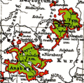
 Ansbach-Bayreuth 1792.png 1,180 × 825; 590 KB
-
 Ansbach-Bayreuth 1805.png 1,180 × 825; 498 KB
-
 Ansbach-Bayreuth.png 361 × 359; 44 KB
-
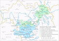
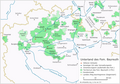
 Fraenkischer Reichskreis.png 2,360 × 1,650; 1.42 MB
-
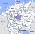 Franconian Circle-2005-10-15-en.png 727 × 714; 67 KB
-
 Franconian Circle.png 2,360 × 1,650; 1.41 MB
-
 FRK 1789 de.png 2,360 × 1,650; 1.24 MB
-
 FRK 1789 en.png 2,360 × 1,650; 1.22 MB
-
 Fsm-Bayreuth 1791.png 1,180 × 825; 448 KB
-
 Fsm-Bt-Oberland 1791.png 1,180 × 825; 464 KB
-
 Fsm-Bt-Unterland 1791.png 1,180 × 825; 463 KB
-
 Fürstentum Hohenlohe Karte.png 9,319 × 7,805; 189.14 MB
-
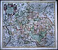
 Karte des fränkischen Reichskreises.jpg 4,982 × 4,200; 19.7 MB
-
 Karte Fränkischer Reichskreis.jpg 5,018 × 4,317; 25.91 MB
-
 Principado de Bayreuth.png 1,180 × 825; 443 KB
-
 Principality of Bayreuth.png 1,180 × 825; 450 KB
-
 Principato di Bayreuth.png 1,180 × 825; 447 KB
-
 Principaute de Bayreuth.png 1,180 × 825; 451 KB
-
 Vorstendom Bayreuth.png 1,180 × 825; 449 KB


