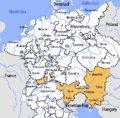
Category:Maps of the Austrian Circle
Jump to navigation
Jump to search
Subcategories
This category has only the following subcategory.
Media in category "Maps of the Austrian Circle"
The following 13 files are in this category, out of 13 total.
-
Oostr1477.png 800 × 600; 1.38 MB
-
Autriche antérieure.png 900 × 730; 37 KB
-
(1854) Karte von KRAIN im Mittelalter.jpg 2,699 × 2,105; 3.14 MB
-
(1854) Diöcesankarte von KRAIN (1462-1787).jpg 2,655 × 2,181; 3.02 MB
-
Austrian Circle-2005-10-14-de.png 727 × 714; 66 KB
-
Austrian Circle-2005-10-14-en.png 727 × 714; 67 KB
-
Austrian Circle-hu.PNG 610 × 599; 206 KB
-
Der Oesterreichische Kreis 1806.jpg 2,503 × 1,862; 1.38 MB
-
HRR 1789-Grafschaft-Werdenfels.svg 1,000 × 892; 87 KB
-
Karte Werdenberger.png 1,500 × 2,194; 615 KB
-
Locator Austrian Circle.svg 1,165 × 1,140; 193 KB
-
The Austrian Circle WDL247.png 1,352 × 1,024; 2.75 MB
-
Wappen,Herkunft und Ahnentafel.jpg 412 × 200; 78 KB


