Category:Maps of the history of the Republic of Karelia
Jump to navigation
Jump to search
Federal subjects of the Russian Federation:
Republics: Adygea · Bashkortostan · Buryatia · Chechnya · Chuvashia · (Crimea) · Dagestan · Ingushetia · Kabardino-Balkaria · Kalmykia · Karachay–Cherkessia · Karelia · Mari El · Mordovia · North Ossetia — Alania · Tatarstan · UdmurtiaKrais: Krasnoyarsk · Primorsky ·
Oblasts: Arkhangelsk · Belgorod · Bryansk · Kursk · Leningrad · Moscow · Murmansk · Oryol · Pskov · Smolensk · Tver · Voronezh ·
Federal cities: Moscow · Saint Petersburg ·
Autonomous oblast:
Autonomous okrugs:
- Maps of the history of the Republic of Karelia (est. 1956) — in the northwestern Soviet Union and Russia.
Subcategories
This category has the following 2 subcategories, out of 2 total.
Media in category "Maps of the history of the Republic of Karelia"
The following 24 files are in this category, out of 24 total.
-
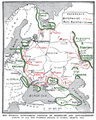
 1928 atlas of the Soviet Union (Murmansk Oblast).jpg 1,206 × 1,078; 590 KB
-
 ApproxPositionsWWI-1919.png 717 × 895; 629 KB
-
 East Karelia municipalities.svg 1,100 × 2,200; 380 KB
-
 Itä-Karjala.sijainti.png 1,195 × 2,606; 516 KB
-
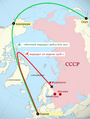 KAL Flight 902's flightplan.png 1,083 × 1,436; 391 KB
-
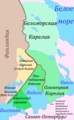 Karelia, historical area.png 349 × 565; 65 KB
-
 Karelien heute2.PNG 453 × 600; 18 KB
-
 Karelien Landschaften.PNG 445 × 764; 22 KB
-
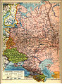 Karta över de europeiska delarna av Sovjetunionen på 1920-talet.jpg 2,548 × 3,480; 1.81 MB
-
 Kollaan-taistelut-maalis-1940.png 341 × 445; 214 KB
-
 Republic of Uhtua.svg 547 × 1,199; 154 KB
-
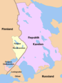
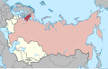 Soviet Union - Karelian ASSR.svg 592 × 376; 255 KB
-
 Suojärvi location map.PNG 501 × 599; 103 KB
-
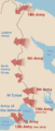
 The scheme of the Red Army offensive in the Winter War.png 1,640 × 2,328; 904 KB
-
 Téli háború.PNG 341 × 800; 23 KB
-
 Viena-expedition.png 535 × 504; 18 KB
-
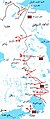
 Winter War Soviet attacks December 1939 russian.png 421 × 1,000; 46 KB
-
 Winter-War-Overview-es.png 341 × 800; 48 KB
-
 Winter-War-Overview.png 341 × 800; 42 KB
-
 Winterwar-december1939-soviet-attacks-ar.jpg 421 × 1,000; 161 KB
-
 Winterwar-december1939-soviet-attacks.png 421 × 1,000; 81 KB
-
 Winterwaroverview.JPG 615 × 939; 139 KB
-
 ´´Puolisotilaallinen kartta´´ 1 100.000 Kurkijoki 1924.jpg 1,283 × 1,195; 872 KB
-
 Карта Мурманской железной дороги. 1926 г. Российская государственная библиотека.jpg 5,268 × 8,268; 5.6 MB
.jpg)


