Category:Maps of the history of Pskov Oblast
Jump to navigation
Jump to search
Federal subjects of the Russian Federation:
Republics: Adygea · Bashkortostan · Buryatia · Chechnya · Chuvashia · (Crimea) · Dagestan · Ingushetia · Kabardino-Balkaria · Kalmykia · Karachay–Cherkessia · Karelia · Mari El · Mordovia · North Ossetia — Alania · Tatarstan · UdmurtiaKrais: Krasnoyarsk · Primorsky ·
Oblasts: Arkhangelsk · Belgorod · Bryansk · Kursk · Leningrad · Moscow · Murmansk · Oryol · Pskov · Smolensk · Tver · Voronezh ·
Federal cities: Moscow · Saint Petersburg ·
Autonomous oblast:
Autonomous okrugs:
Subcategories
This category has only the following subcategory.
M
Media in category "Maps of the history of Pskov Oblast"
The following 12 files are in this category, out of 12 total.
-
 Pol 1792.jpg 7,352 × 5,962; 5.71 MB
-
 Pskov Okrug and Velikoluksky Okrug 1927.jpg 1,000 × 1,137; 195 KB
-
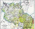 PskovGub.jpg 1,570 × 1,276; 298 KB
-
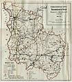
 Великолукский уезд.png 400 × 300; 19 KB
-

-
 Новоржевский уезд.png 400 × 300; 19 KB
-
 Опочецкий уезд.png 400 × 300; 19 KB
-
 Островский уезд.png 400 × 300; 19 KB
-
 Порховский уезд.png 400 × 300; 19 KB
-
 Псковский уезд.png 400 × 300; 19 KB
-
 Торопецкий уезд.png 400 × 300; 19 KB
-
 Холмский уезд.png 400 × 300; 19 KB


.jpg)


