Category:Maps of the history of Crimea
Jump to navigation
Jump to search

Subcategories
This category has the following 10 subcategories, out of 10 total.
*
M
- Maps of Taurida Oblast (4 F)
Media in category "Maps of the history of Crimea"
The following 35 files are in this category, out of 35 total.
-
 1390 Italien colonies.png 1,652 × 1,221; 1.17 MB
-
 1600.png 450 × 371; 75 KB
-
 C. 1519 Europe.jpg 4,212 × 3,212; 4.87 MB
-
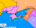
 Caffa and Theodoro 2-es.svg 996 × 660; 85 KB
-
 Caffa and Theodoro 2.svg 996 × 660; 350 KB
-
 Caffa and Theodoro-ar.png 700 × 470; 65 KB
-
 Caffa and Theodoro.PNG 700 × 470; 89 KB
-
 Caffa and Theodoro.png 622 × 407; 23 KB
-
 Chersonesos 988 war map.jpg 591 × 393; 59 KB
-
 Crimea 2nd century BC map hu.svg 1,000 × 779; 228 KB
-
 Crimea 2nd century BC map-es.svg 1,070 × 843; 508 KB
-
 Crimea 2nd century BC map.png 430 × 335; 30 KB
-
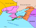
 Crimea nel XV secolo.svg 1,000 × 678; 62 KB
-
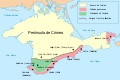
 Crimea RUS.svg 1,051 × 654; 205 KB
-
 Crimean Tatar 1939-num.png 2,200 × 1,384; 405 KB
-
 CrimeanTatar1939.png 667 × 471; 61 KB
-
 CrimeeXV-s.jpg 394 × 311; 147 KB
-
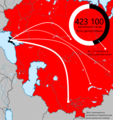 Deportation of the Crimean Tatars uk.png 2,160 × 2,290; 783 KB
-
 Einsatzgruppen Crimea.jpg 860 × 554; 156 KB
-
 General District of Crimea (1942).svg 450 × 456; 486 KB
-
 Gub Tavria ethno 1897.jpg 983 × 606; 259 KB
-
 Krimeo 15a jc.png 600 × 470; 27 KB
-
 KrymNazwy.jpg 447 × 245; 15 KB
-
 Krymska operatsia.jpg 720 × 1,040; 139 KB
-
 Map of Ukraine political Taurida.png 800 × 559; 135 KB
-
 New Russia on territory of Ukraine.png 800 × 549; 144 KB
-
 Russo-Turkish War of 1735-1739.svg 800 × 566; 970 KB
-
 Siedlungsgebiet der Krimtschaken.PNG 218 × 94; 2 KB
-
 Tartar Crimea.png 600 × 389; 12 KB
-
 Theodoro-es.svg 2,225 × 1,243; 49 KB
-
 Theodoro-fr.svg 2,225 × 1,243; 48 KB
-
 Theodoro.png 680 × 302; 236 KB
-
 Wrangelcrimeaforcespeak.png 490 × 340; 11 KB
-

-
 قریم یورتی دا نقشہ.gif 872 × 720; 179 KB


.svg)


