Category:Maps of the history of Karelia
Jump to navigation
Jump to search
English: Maps of the History of Karelia in Northern Europe.
- The Karelia Region is located in eastern Finland and northwestern Russia.
Subcategories
This category has the following 4 subcategories, out of 4 total.
M
R
Media in category "Maps of the history of Karelia"
The following 27 files are in this category, out of 27 total.
-
 Bellum Hiemale 1.PNG 618 × 799; 54 KB
-
 Bellum Hiemale 2.PNG 341 × 791; 41 KB
-
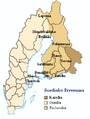
 Finnish Karelia 1864-1940.png 401 × 508; 43 KB
-
 Finnish Karelia, 1864-1940.svg 352 × 476; 40 KB
-
 Finno-Ugric tribes, 10th century.jpg 797 × 697; 151 KB
-
 Grand-Duchy-of-Finland.png 351 × 753; 171 KB
-
 Igora1201.gif 1,035 × 740; 67 KB
-
 Igora1401.gif 1,035 × 740; 76 KB
-
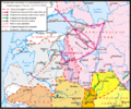
 Karelia overview.png 1,614 × 865; 889 KB
-
 Kareliantzinakoprobintzia.PNG 308 × 408; 25 KB
-
 Karjala kaart.jpg 509 × 540; 62 KB
-
 Laatokan Karjala.svg 1,600 × 2,000; 2.21 MB
-
 Luovutetun Karjalan kunnat 1940.svg 2,000 × 2,400; 3.5 MB
-
 Map of Finnish areas ceded to Soviet Union 1940.png 250 × 462; 35 KB
-
 Municipalities in Ceded Karelia 1940.svg 2,000 × 2,400; 2.57 MB
-
 Pogosts Lopskie.png 400 × 600; 80 KB
-
 Pogosts of Zaonezhie.png 377 × 542; 54 KB
-
 Rus-10c-ethn.png 2,241 × 2,731; 257 KB
-
 Rus-1240-nevski.png 1,399 × 1,163; 85 KB
-
 Svpmap karelia.png 275 × 400; 17 KB
-
 Zaonezhye, Olonets plants.jpg 1,565 × 1,233; 471 KB
-
 Административная карта Кольского полуострова в XVI-XVII вв..jpg 3,221 × 2,375; 861 KB
-
 Водская пятина.jpg 1,325 × 2,861; 2.18 MB
-
 Карелия в XVI веке.jpg 1,820 × 1,657; 1.54 MB
-
 Карельская трудовая коммуна и Олонецкая губерния (1920).png 792 × 1,024; 637 KB
-

-
 Обонежская пятина.jpg 1,385 × 3,157; 2.55 MB


.png)
.jpg)
