Category:Maps of the history of the Democratic Republic of the Congo
Jump to navigation
Jump to search
Countries of Africa: Algeria · Angola · Benin · Botswana · Burkina Faso · Burundi · Cameroon · Central African Republic · Chad · Democratic Republic of the Congo · Republic of the Congo · Djibouti · Egypt‡ · Equatorial Guinea · Eritrea · Eswatini · Ethiopia · Gabon · The Gambia · Ghana · Guinea · Guinea-Bissau · Ivory Coast · Kenya · Lesotho · Liberia · Libya · Madagascar · Malawi · Mali · Mauritania · Morocco · Mozambique · Namibia · Niger · Nigeria · Rwanda · Senegal · Sierra Leone · Somalia · South Africa · South Sudan · Sudan · Tanzania · Togo · Tunisia · Uganda · Zambia · Zimbabwe
Limited recognition: Ambazonia · Azawad · Somaliland – Other areas: Ceuta · Melilla · Réunion · Western Sahara
‡: partly located in Africa
Limited recognition: Ambazonia · Azawad · Somaliland – Other areas: Ceuta · Melilla · Réunion · Western Sahara
‡: partly located in Africa
Subcategories
This category has the following 7 subcategories, out of 7 total.
M
- Maps of Belgian Congo (47 F)
- Maps of South Kasai (8 F)
- Maps of the Congo Crisis (16 F)
- Maps of the Congo Free State (59 F)
Z
- Maps of Zaire (21 F)
Media in category "Maps of the history of the Democratic Republic of the Congo"
The following 53 files are in this category, out of 53 total.
-
 CarteBasCongo1913.JPG 2,464 × 1,436; 1.7 MB
-
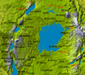
 Congo historical regions.png 598 × 386; 619 KB
-
 Congo Kinshasa 1966 (Numbered).png 500 × 505; 68 KB
-
 Congo States.png 577 × 710; 96 KB
-
 Congo wall map - Exploration itineraries (legend) - AfricaMuseum.jpg 3,024 × 4,032; 3.91 MB
-
 Congo wall map - Exploration itineraries - AfricaMuseum.jpg 4,032 × 3,024; 4.04 MB
-
 East Congo conflict map.svg 1,150 × 1,095; 977 KB
-
 Extent of Kamwina Nsapu rebellion.svg 1,240 × 1,181; 819 KB
-
 First Congo War (April 12, 1997).svg 1,240 × 1,181; 1,009 KB
-
 First Congo War (December 24, 1996).svg 1,240 × 1,181; 982 KB
-
 First Congo War (February 23, 1997).svg 1,240 × 1,181; 987 KB
-
 First Congo War (March 15, 1997).svg 1,240 × 1,181; 980 KB
-
 First Congo War (May 16, 1997).svg 1,240 × 1,181; 984 KB
-
 First Congo War (November 15, 1996).svg 1,240 × 1,181; 975 KB
-
 First Congo War map ar.png 2,990 × 2,848; 2.23 MB
-
 First Congo War map en.png 2,990 × 2,848; 2.18 MB
-
 First Congo War offensive map de bitmap.png 2,990 × 2,848; 2.18 MB
-
 First Congo War offensive map de.svg 1,150 × 1,095; 911 KB
-
 First Congo War offensive map es.svg 1,150 × 1,095; 942 KB
-
 Great Lakes Kingdoms.png 592 × 523; 792 KB
-
 Immigration des Bavira au cours des siècles.jpg 2,908 × 2,903; 765 KB
-
 Kivu conflict map 2.svg 1,150 × 1,095; 977 KB
-
 Loango-Angolakust.jpg 392 × 532; 30 KB
-
 Map of the CNPSC conflict.svg 243 × 253; 752 KB
-
 Msiri's kingdom in 1880 760x460 lo-res.jpg 763 × 472; 89 KB
-
 RDCongo-1960-200px.png 200 × 202; 17 KB
-
 RDCongo-1966-200px.png 200 × 202; 18 KB
-
 RDCongo-1988-200px.png 200 × 202; 18 KB
-
 Realluba.JPG 508 × 188; 16 KB
-
 Second Congo War (August 22, 1998).svg 1,240 × 1,181; 985 KB
-
 Second Congo War (December 24, 1998).svg 1,240 × 1,181; 990 KB
-
 Second Congo War (January 15, 2001).svg 1,240 × 1,181; 1,016 KB
-
 Second Congo War (July 15, 1999).svg 1,240 × 1,181; 1,007 KB
-
 Second Congo War (June 11, 2000).svg 1,240 × 1,181; 1,014 KB
-
 Second Congo War (October 13, 1998).svg 1,240 × 1,181; 987 KB
-
 Second Congo War 1998 map en.png 2,990 × 2,848; 1.75 MB
-
 Second Congo War 1998 map vector.svg 1,150 × 1,095; 774 KB
-
 Second Congo War 1998 map.png 2,990 × 2,848; 1.75 MB
-
 Second Congo War 1999 map de.png 2,990 × 2,848; 2.11 MB
-
 Second Congo War 1999 map de.svg 1,150 × 1,095; 805 KB
-
 Second Congo War 1999 map en.png 2,990 × 2,848; 2.1 MB
-
 Second Congo War 2000 map vector.svg 1,150 × 1,095; 811 KB
-
 Second Congo War 2000 map.png 2,990 × 2,848; 2.02 MB
-
 Second Congo War 2001 map vector-es.svg 1,150 × 1,095; 729 KB
-
 Second Congo War 2001 map vector.svg 1,150 × 1,095; 815 KB
-
 Second Congo War 2001 map.png 2,990 × 2,848; 1.73 MB
-
 Second Congo War Africa map ar.png 1,024 × 969; 273 KB
-
 Second Congo War Africa map de.png 1,525 × 1,440; 418 KB
-
 Second Congo War Africa map en.png 1,526 × 1,444; 407 KB
-
 Second Congo War Africa map en.svg 1,525 × 1,440; 992 KB
-
 Second Congo War Africa map.svg 1,525 × 1,440; 952 KB
-
 Skärmklipp 2019-07-20 21.47.06.png 1,920 × 1,080; 1.38 MB
-
 Österreichische-Congo-Expedition-(1885-87).jpg 1,868 × 2,501; 4.73 MB


.png)

_-_AfricaMuseum.jpg)


.svg)
.svg)
.svg)
.svg)
.svg)
.svg)


.svg)
.svg)
.svg)
.svg)
.svg)
.svg)


.jpg)