Category:Maps of the history of Western Sahara
Jump to navigation
Jump to search
Countries of Africa: Algeria · Angola · Benin · Botswana · Burkina Faso · Burundi · Cameroon · Central African Republic · Chad · Democratic Republic of the Congo · Republic of the Congo · Djibouti · Egypt‡ · Equatorial Guinea · Eritrea · Eswatini · Ethiopia · Gabon · The Gambia · Ghana · Guinea · Guinea-Bissau · Ivory Coast · Kenya · Lesotho · Liberia · Libya · Madagascar · Malawi · Mali · Mauritania · Morocco · Mozambique · Namibia · Niger · Nigeria · Rwanda · Senegal · Sierra Leone · Somalia · South Africa · South Sudan · Sudan · Tanzania · Togo · Tunisia · Uganda · Zambia · Zimbabwe
Limited recognition: Ambazonia · Azawad · Somaliland – Other areas: Ceuta · Melilla · Réunion · Western Sahara
‡: partly located in Africa
Limited recognition: Ambazonia · Azawad · Somaliland – Other areas: Ceuta · Melilla · Réunion · Western Sahara
‡: partly located in Africa
Subcategories
This category has the following 4 subcategories, out of 4 total.
Media in category "Maps of the history of Western Sahara"
The following 12 files are in this category, out of 12 total.
-
 Expansión Marruecos 1956.svg 532 × 600; 654 KB
-
 Grand Maroc.svg 299 × 304; 36 KB
-
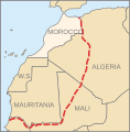 Greater Morocco.svg 299 × 304; 36 KB
-
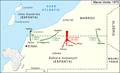
 Grüner Marsch Karte-ar.png 1,200 × 734; 153 KB
-
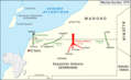
 Grüner Marsch Karte-es.png 1,200 × 734; 60 KB
-
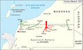 Grüner Marsch Karte.png 1,200 × 734; 174 KB
-
 Martxa Berdea.png 1,200 × 734; 169 KB
-
 Marxa Verda.png 1,200 × 734; 151 KB
-
 SaharaOccidentalDivision.jpg 1,153 × 1,111; 271 KB
-
 Western sahara territorial control 1976-1979 topographic map-en.svg 1,187 × 1,001; 897 KB
-
 Western sahara territorial control 1979-1981 topographic map-en.svg 1,187 × 1,001; 873 KB
-


