Category:Maps of the Congo Free State
Jump to navigation
Jump to search
Media in category "Maps of the Congo Free State"
The following 59 files are in this category, out of 59 total.
-
 KONGO1877.JPG 6,137 × 5,393; 5.58 MB
-
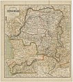
 1884 Map of the Belgium Congo.jpg 1,000 × 836; 184 KB
-

-

-
 71 of 'Chez les Abarambos. Ce que devient l'Afrique mystérieuse, etc' (11236995843).jpg 2,272 × 1,454; 293 KB
-
 8 of 'De onafhankelijke Congostaat. Met eene kaart en 34 lichtteekeningen' (11250731263).jpg 2,512 × 2,995; 1.24 MB
-

-

-
 A Map of the route of the Emin Pasha Relief Expedition Wellcome L0034226.jpg 7,770 × 4,512; 17.79 MB
-

-
 Campagne arabe - Dhanis.jpg 1,484 × 937; 151 KB
-
 Campagne arabe - général.jpg 1,015 × 1,331; 202 KB
-
 Campagne arabe - préliminaire.jpg 955 × 1,144; 185 KB
-
 Campagne contre les révoltés de l'expédition Dhanis, 1897-1900.jpg 1,225 × 835; 144 KB
-
 Campagne contre les révoltés de l'expédition Dhanis.jpg 952 × 1,338; 178 KB
-
 Campagne contre les révoltés de Luluabourg.jpg 939 × 1,010; 132 KB
-
 Carte de l'Afrique politique en 1888 par E Banninfg pour le BCK - IMG 4379.jpg 3,888 × 5,184; 5.37 MB
-

-
 Carte du Congo belge... - btv1b531972816.jpg 8,212 × 9,308; 13.17 MB
-
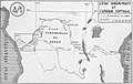
 Circuit effectué par la commission.png 839 × 651; 70 KB
-
 Commission Anglo-Congolaise du 30ème. Méridien. (WOOS-14-10-2-1).jpg 6,442 × 7,313; 23.37 MB
-
 Commission Anglo-Congolaise du 30ème. Méridien. (WOOS-14-10-2-2).jpg 6,296 × 8,680; 28.01 MB
-
 Congo concessions.JPG 694 × 625; 425 KB
-
 Congostate00boul orig 0425 ergebnis.png 3,540 × 3,616; 12.88 MB
-
 EHC K134694 2021 0001-w2XgDPLBUNHhitOZoTFZ89Qg.jpg 6,684 × 5,276; 10.83 MB
-
 EIC - frontières 1885.jpg 1,634 × 1,038; 181 KB
-
 Etat des connaissances sur lAfrique en 1876.jpg 621 × 673; 58 KB
-
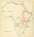
 Europe in Africa in the nineteenth century (1895) (14790566493).jpg 2,810 × 1,744; 585 KB
-
 Exploration Ubangi-Itimbiri.jpg 1,434 × 1,041; 188 KB
-
 Expédition Dhanis, 17-02-1897.jpg 518 × 904; 75 KB
-
 Expédition Van Kerckhoven.jpg 1,774 × 1,037; 209 KB
-
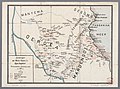
 Expéditions au Katanga.jpg 972 × 1,161; 158 KB
-
 Expéditions au nord du Bomu.jpg 926 × 1,358; 166 KB
-
 Expéditions du Kwango.jpg 1,178 × 940; 152 KB
-
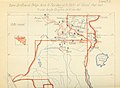
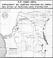 Force Publique 1888-1914.jpg 1,045 × 1,138; 140 KB
-
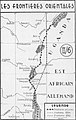 Frontières orientales congo.jpg 917 × 1,446; 151 KB
-
 KONGO BELGIEN.png 526 × 524; 52 KB
-
 Kongovrijstaat.jpg 499 × 511; 164 KB
-
 Kuilu-Niadi - Banana - Bolobo.jpg 1,207 × 1,043; 141 KB
-
 Les campagnes mahdistes générale.jpg 848 × 1,193; 141 KB
-
 Les campagnes mahdistes.jpg 904 × 1,175; 164 KB
-
 Les expeditions de la Societe Internationale Africaine.png 835 × 646; 670 KB
-
 Les Explorateurs du Haut Congo LOEuvre de Stanley et de Hanssens.png 3,949 × 2,891; 6.8 MB
-
 Les Explorations du Kassai.png 877 × 625; 717 KB
-
 Les explorations du Sud et du Centre africains jusquen 1876.jpg 628 × 677; 45 KB
-
 Les Grandes Expéditions.jpg 1,042 × 1,411; 202 KB
-
 LocationCongoFreeState.png 1,357 × 628; 44 KB
-

-
 Loeuvrecivilisat00reni 0253.jpg 988 × 723; 101 KB
-
 Loeuvrecivilisat00reni 0341.jpg 988 × 720; 83 KB
-
 Loeuvrecivilisat00reni 0345 Angola.jpg 988 × 720; 88 KB
-

-
 Map of the Congo Territories—Under the personal rule of King Leopold II.jpg 4,367 × 4,050; 10.7 MB
-
 PMa B 471 Tervuren.jpg 600 × 382; 234 KB
-
 Révolte de Shinkakasa.jpg 1,151 × 752; 126 KB
-

-
 Sunprint Showing 30th Meridian & Proposed Boundary (1908) - War Office ledger (WOOS-14-11).jpg 3,671 × 8,739; 13.34 MB
-
 The American Museum journal (c1900-(1918)) (17973537689).jpg 1,900 × 2,644; 820 KB
-


.jpg)
.jpg)
.jpg)


.jpg)
.jpg)


_(14790566493).jpg)


_-_War_Office_ledger_(WOOS-14-11).jpg)
)_(17973537689).jpg)
