
Category:Maps of the Democratic Republic of the Congo
Countries of Africa: Algeria · Angola · Benin · Botswana · Burkina Faso · Burundi · Cameroon · Cape Verde · Central African Republic · Chad · Comoros · Democratic Republic of the Congo · Republic of the Congo · Djibouti · Egypt‡ · Equatorial Guinea · Eritrea · Eswatini · Ethiopia · Gabon · The Gambia · Ghana · Guinea · Guinea-Bissau · Ivory Coast · Kenya · Lesotho · Liberia · Libya · Madagascar · Malawi · Mali · Mauritania · Mauritius · Morocco · Mozambique · Namibia · Niger · Nigeria · Rwanda · São Tomé and Príncipe · Senegal · Seychelles · Sierra Leone · Somalia · South Africa · South Sudan · Sudan · Tanzania · Togo · Tunisia · Uganda · Zambia · Zimbabwe
Limited recognition: Ambazonia · Azawad · Puntland · Sahrawi Arab Democratic Republic · Somaliland – Other areas: Canary Islands · Ceuta · Madeira · Mayotte · Melilla · Réunion · Saint Helena, Ascension and Tristan da Cunha · Scattered Islands in the Indian Ocean · Western Sahara
‡: partly located in Africa
Wikimedia category | |||||
| Upload media | |||||
| Instance of | |||||
|---|---|---|---|---|---|
| Category combines topics | |||||
 | |||||
Maps of the Democratic Republic of the Congo.
Subcategories
This category has the following 30 subcategories, out of 30 total.
*
B
C
E
F
H
L
P
S
T
Pages in category "Maps of the Democratic Republic of the Congo"
The following 2 pages are in this category, out of 2 total.
Media in category "Maps of the Democratic Republic of the Congo"
The following 43 files are in this category, out of 43 total.
-
 3D Relief Model of the Kakoi-Koda Focus.png 567 × 339; 364 KB
-
 Bevölkerungsdichte der DR Kongo.png 500 × 500; 50 KB
-
 Cabinda, R. Congo, D.R. Congo, Angola.png 380 × 370; 18 KB
-
 Carte Congo ligne haute tension Inga.jpg 519 × 545; 105 KB
-
 Congo (Republic of the Congo) - DPLA - 0fa35bec22decdaec84a539cbb8353bc.jpg 2,548 × 3,276; 5.86 MB
-
 Congo Dem Rep Regions Map.png 3,000 × 3,118; 1.61 MB
-
 Congo names.png 380 × 370; 18 KB
-
 Conventional Congo Basin - DPLA - 5dbb94c071822e720e92ec7bb62fad5f.jpg 8,874 × 6,236; 6.43 MB
-
-

-
 Democratic Republic of Congo Base Map.png 1,108 × 694; 155 KB
-
 Democratic Republic of the Congo - DPLA - 074b8d3d7ba1f0cf3e93930a1a3947fd.jpg 2,554 × 3,274; 5.56 MB
-
 Democratic Republic of the Congo provinces by population density (2016).png 2,700 × 3,000; 736 KB
-
 Democratic Republic of the Congo provinces by total population (2016).png 2,700 × 3,000; 771 KB
-
 Demokratische Republik Kongo Pressefreiheit 2008.png 745 × 1,053; 107 KB
-
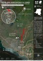
 DRC cases south and north kivu , ituri.jpg 1,237 × 1,177; 195 KB
-
 DRCongo telephone.png 2,000 × 2,000; 28 KB
-
 ECHO DRC Province Orientale Editable A4 Landscape.pdf 1,754 × 1,239; 411 KB
-
 ECHO DRC Équateur Editable A4 Landscape.pdf 1,754 × 1,239; 407 KB
-
 HDVC Inga-Shaba.png 330 × 355; 39 KB
-
 Jadotville.jpg 3,150 × 4,200; 3.33 MB
-
 Kaartje van Upemba depression.png 672 × 605; 240 KB
-
 Map of DRC.jpg 745 × 928; 147 KB
-
 Mapa da República Democrática do Congo (OCHA).svg 254 × 254; 681 KB
-
 MatadiHEB.PNG 339 × 333; 8 KB
-
 Mbunda people location in DRC Congo.jpg 3,941 × 3,776; 763 KB
-
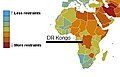 Medienlage in der DR Kongo.jpg 371 × 239; 12 KB
-
 Momboyo OSM.png 1,031 × 553; 137 KB
-
 Monj'Okuli.jpg 720 × 720; 219 KB
-
 MONUC deployments Dec 2009.png 1,166 × 866; 333 KB
-
 MONUC deployments Sep 2017.png 1,498 × 1,136; 1.73 MB
-
 MONUC deployments Sep 2019.png 1,786 × 1,330; 1.24 MB
-
 Monuc-mapa.jpg 601 × 450; 148 KB
-
 Monuc.pdf 1,650 × 1,275; 620 KB
-
 Operation Kitona Diagram.png 518 × 366; 29 KB
-
 Population density of Democratic Republic of Congo provinces.png 5,566 × 6,085; 1.19 MB
-
 Republic of the Congo- Selected Ethnic Groups - DPLA - ae869a2ef6e0b4f82877e22da129519b.jpg 2,556 × 3,278; 6.96 MB
-
 Ruwenzori Map.jpg 2,700 × 1,737; 349 KB
-
 Rwenzori (centre).png 853 × 1,295; 2.33 MB
-
 Situation in Kinshasa (August 1998).svg 2,789 × 2,219; 40.71 MB
-
 The Kivus, eastern DRC (6940585108).jpg 4,256 × 2,832; 3.06 MB
-
 Un-eastern-congo.png 2,057 × 2,582; 1.3 MB
-
 UTC hue4map DRC.png 2,000 × 2,022; 407 KB


_-_DPLA_-_0fa35bec22decdaec84a539cbb8353bc.jpg)


.png)
.png)


.svg)


.png)
.svg)
.jpg)

