Category:Maps of the history of Zambia
Jump to navigation
Jump to search
Countries of Africa: Algeria · Angola · Benin · Botswana · Burkina Faso · Burundi · Cameroon · Central African Republic · Chad · Democratic Republic of the Congo · Republic of the Congo · Djibouti · Egypt‡ · Equatorial Guinea · Eritrea · Eswatini · Ethiopia · Gabon · The Gambia · Ghana · Guinea · Guinea-Bissau · Ivory Coast · Kenya · Lesotho · Liberia · Libya · Madagascar · Malawi · Mali · Mauritania · Morocco · Mozambique · Namibia · Niger · Nigeria · Rwanda · Senegal · Sierra Leone · Somalia · South Africa · South Sudan · Sudan · Tanzania · Togo · Tunisia · Uganda · Zambia · Zimbabwe
Limited recognition: Ambazonia · Azawad · Somaliland – Other areas: Ceuta · Melilla · Réunion · Western Sahara
‡: partly located in Africa
Limited recognition: Ambazonia · Azawad · Somaliland – Other areas: Ceuta · Melilla · Réunion · Western Sahara
‡: partly located in Africa
| NO WIKIDATA ID FOUND! Search for Maps of the history of Zambia on Wikidata | |
| Upload media |

Subcategories
This category has the following 3 subcategories, out of 3 total.
*
R
Media in category "Maps of the history of Zambia"
The following 7 files are in this category, out of 7 total.
-
 Gwisho culture map.png 326 × 349; 13 KB
-
 Mbunda Chiefs Location Map in Zambia.jpg 5,848 × 4,134; 1.2 MB
-
 Munhumutapa.jpg 642 × 706; 512 KB
-
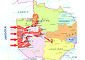 The Mbunda migration into Zambia.jpg 1,768 × 1,241; 120 KB
-
 The Mbunda Migration Map into Zambia.jpg 5,848 × 4,134; 1.21 MB
-
 The Mbunda people migration areas in the now Zambia.jpg 5,848 × 4,134; 1.21 MB
-
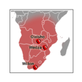 Wilton culture map.png 253 × 253; 5 KB


