
Category:Maps of the Low Countries in the 14th century
English: This category is about non-contemporary maps showing historical territories of the Low Countries as they were in the 14th century.
Contemporary old maps belong into: Category:Old maps of the Netherlands and Category:Old maps of Belgium and the subcategories.
Contemporary old maps belong into: Category:Old maps of the Netherlands and Category:Old maps of Belgium and the subcategories.
Maps of the medieval Low Countries: (BCE) (CE) 5th century · 8th century · 9th century · 10th century · 11th century · 12th century · 13th century · 14th century · 15th century · 16th century · 17th century · 18th century ·
Media in category "Maps of the Low Countries in the 14th century"
The following 61 files are in this category, out of 61 total.
-
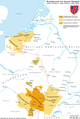
 C. 1350 Holy Roman Empire (Northwestern region).jpg 940 × 1,201; 1.42 MB
-
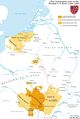
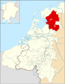
 Locator Duchy of Guelders and County of Zutphen (1350).svg 2,818 × 3,608; 431 KB
-
 Paises Bajos, 1350-es.svg 2,818 × 3,608; 1.94 MB
-
 Plain map of the low countries (1350)-NL.png 1,063 × 1,080; 272 KB
-
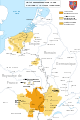
 Political map of Limburg (1350)-NL.svg 866 × 1,206; 888 KB
-
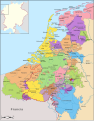
 Political map of the Low Countries (1350)-es.svg 2,818 × 3,608; 1.95 MB
-
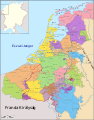
 Political map of the Low Countries (1350)-FR.svg 2,818 × 3,608; 815 KB
-
 Political map of the Low Countries (1350)-hu.svg 2,818 × 3,608; 850 KB
-
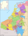 Political map of the Low Countries (1350)-NL.svg 2,818 × 3,608; 886 KB
-
 County of Flanders (topogaphy).png 760 × 645; 190 KB
-
 Sluys and Cadsand in 100 years war.jpg 490 × 294; 88 KB
-
 Carte Etat bourguignon (Philippe le Hardi).svg 1,195 × 1,786; 434 KB
-
 Carte Etat bourguignons 1-es.svg 1,195 × 1,786; 1.54 MB
-
 Etat bourguignons.png 1,210 × 1,851; 618 KB
-
 Karte Haus Burgund 1.png 2,500 × 3,724; 859 KB
-
 Karte Haus Burgund 2-es.svg 5,442 × 7,100; 1.85 MB
-
 Karte Haus Burgund 2.png 1,200 × 1,787; 250 KB
-
 Karte-Haus-Burgund-FR.png 2,500 × 3,724; 831 KB
-
 Burgundian State 1364-1404.svg 5,805 × 7,573; 1,004 KB
-
 Reiseroute von Johanna von Bayern 1370.png 1,000 × 983; 263 KB
-
 C. 1400 Northern Europe Hanseatic League.jpg 2,907 × 1,933; 3.03 MB
-
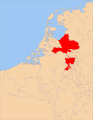
 Duchy of Brabant and Duchy of Guelders (1350) locator map.svg 2,813 × 3,602; 384 KB
-
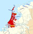 Holland1350-af.svg 2,050 × 2,110; 267 KB
-
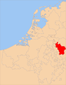
 Locator County of Artois (1350).svg 2,818 × 3,608; 422 KB
-
 Locator County of Cleves (1350).svg 2,818 × 3,608; 427 KB
-
 Locator County of Dalhem (1350).svg 2,818 × 3,608; 427 KB
-
 Locator County of Flanders (1350).svg 2,818 × 3,608; 422 KB
-
 Locator County of Holland (1350).svg 2,818 × 3,608; 427 KB
-
 Locator County of Loon (1350).svg 2,818 × 3,608; 427 KB
-
 Locator County of Luxembourg (1350).svg 2,818 × 3,608; 422 KB
-
 Locator County of Zutphen (1350).svg 2,818 × 3,608; 431 KB
-
 Locator Duchy of Guelders (1350).svg 2,818 × 3,608; 427 KB
-
 Locator Lands of Overmaas (1350).svg 2,818 × 3,608; 399 KB
-
 Locator Lordship of Cuijk (1350).svg 2,818 × 3,608; 427 KB
-
 Locator Lordship of Hertogenrade (1350).svg 2,818 × 3,608; 428 KB
-
 Locator Lordship of Horne (1350).svg 2,818 × 3,608; 427 KB
-
 Locator Lordship of Kessel (1350).svg 2,818 × 3,608; 427 KB
-
 Locator Lordship of Mechelen (1350).svg 2,818 × 3,608; 422 KB
-
 Locator Lorships of Horne and Weert (1350).svg 2,818 × 3,608; 427 KB
-
 Locator Nedersticht of Utrecht (1350).svg 2,818 × 3,608; 422 KB
-
 Locator Oversticht of Urecht (1350).svg 2,818 × 3,608; 427 KB
-
 Locator Prince-Bishopric of Cambrai (1350).svg 2,818 × 3,608; 422 KB
-
 Locator Prince-Bishopric of Liège (1350).svg 2,818 × 3,608; 427 KB
-
 Locator Prince-Bishopric of Tournai (1350).svg 2,818 × 3,608; 427 KB
-
 Locator Prince-Bishopric of Utrecht (1350).svg 2,818 × 3,608; 427 KB
-
 Low Countries Locator Bentheim.svg 1,550 × 2,000; 381 KB
-
 Low Countries Locator Berg.svg 1,550 × 2,000; 381 KB
-
 Low Countries Locator Cleves.svg 1,550 × 2,000; 381 KB
-
 Low Countries Locator Duchy of Julich.svg 1,550 × 2,000; 381 KB
-
 Low Countries Locator Flanders and Artois.svg 1,550 × 2,000; 212 KB
-
 Low Countries Locator Flanders.svg 1,550 × 2,000; 381 KB
-
 Low Countries Locator Gelre.svg 1,550 × 2,000; 381 KB
-
 Low Countries Locator Holland.svg 1,550 × 2,000; 381 KB
-
 Low Countries Locator Prince-Bischopric of Liege.svg 1,550 × 2,000; 381 KB
-
 Low Countries Locator Prince-Bischopric Utrecht.svg 1,550 × 2,000; 381 KB
-
 Modern history; Europe (1904) (14579052990).jpg 2,024 × 2,884; 1.58 MB
-
 Overmaas-na-1785 (cropped).png 1,104 × 862; 178 KB
-
 Overmaas-na-1785.png 2,000 × 1,891; 359 KB
-
 Overmaas-voor-1785 redemptie.png 2,000 × 1,891; 282 KB
-
 Overmaas-voor-1785.png 2,000 × 1,891; 381 KB
-
 War of the Brabantian Succession (1355–1357) locator map.svg 2,813 × 3,602; 388 KB
.jpg)
.svg)

-NL.png)
-NL.svg)
-es.svg)
-FR.svg)
-hu.svg)
-NL.svg)
.png)

.svg)


_locator_map.svg)

.svg)
.svg)
.svg)
.svg)
.svg)
.svg)
.svg)
.svg)
.svg)
.svg)
.svg)
.svg)
.svg)
.svg)
.svg)
.svg)
.svg)
.svg)
.svg)
.svg)
.svg)
.svg)


_(14579052990).jpg)
.png)


_locator_map.svg)