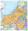
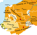
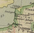
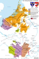
Category:Maps of the Low Countries in the 15th century
Jump to navigation
Jump to search
English: This category is about non-contemporary maps showing historical territories of the Low Countries as they were in the 15th century.
Contemporary old maps belong into: Category:15th-century maps of the Netherlands and Category:15th-century maps of Belgium and the subcategories.
Contemporary old maps belong into: Category:15th-century maps of the Netherlands and Category:15th-century maps of Belgium and the subcategories.
Maps of the medieval Low Countries: (BCE) (CE) 5th century · 8th century · 9th century · 10th century · 11th century · 12th century · 13th century · 14th century · 15th century · 16th century · 17th century · 18th century ·
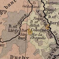
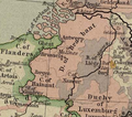
Media in category "Maps of the Low Countries in the 15th century"
The following 27 files are in this category, out of 27 total.
-
 Etat bourguignon Philippe le Bon Fr.png 1,213 × 1,802; 837 KB
-
 Etat bourguignon Philippe le Bon-es.svg 5,442 × 7,100; 2.15 MB
-
 Karte Haus Burgund 3-es.svg 5,442 × 7,100; 1.74 MB
-
 Karte Haus Burgund 3.png 1,200 × 1,787; 281 KB
-
 Kaart Zuidhollandse eilanden in 1421 - A. Beekman.jpg 4,925 × 3,310; 3.5 MB
-
 TA REC 021 Kaart Zuid-Hollandse eilanden St Elizabethsvloed 1421.jpg 6,016 × 4,342; 6.16 MB
-
 C. 1450 Benelux region.jpg 1,079 × 1,201; 1.54 MB
-
 C. 1450 Holy Roman Empire (Northwestern region).jpg 1,019 × 1,243; 1.08 MB
-
 Burgundian northern France 1465–1477.png 416 × 399; 92 KB
-
 Karte Haus Burgund 4 EN.png 2,500 × 3,521; 1.33 MB
-
 Karte Haus Burgund 4.png 2,500 × 3,521; 1.36 MB
-
 Karte Haus Burgund Verwaltu.png 1,200 × 1,787; 227 KB
-
 Bonen1477.png 237 × 230; 88 KB
-
 Karte Haus Burgund 5.png 1,200 × 1,787; 449 KB
-
 Karte-Haus-Burgund 5-es.svg 5,442 × 7,100; 2.12 MB
-
 Limburg1477.png 230 × 231; 98 KB
-
 Luxemburg1477.png 295 × 351; 191 KB
-
 Brabant1477.png 409 × 362; 331 KB
-
 Map Burgundian Netherlands 1477-af.svg 744 × 1,052; 125 KB
-
 Map Burgundian Netherlands 1477.png 591 × 657; 198 KB
-
 C. 1494 France.jpg 1,379 × 1,337; 1.24 MB
-
 Holland 1500.PNG 452 × 551; 682 KB
-
 Karte Haus Burgund 4 ZH.png 1,200 × 1,690; 840 KB
-
 Karte-Haus-Burgund 4-es.svg 5,442 × 7,100; 2.36 MB
-
 Karte-Haus-Burgund 4-FR.png 2,500 × 3,521; 1.34 MB
-
 Map Burgundian Netherlands 1477-en.png 1,123 × 1,249; 825 KB
-
 Map Burgundian Netherlands 1477-fr.svg 748 × 858; 126 KB


.jpg)


