Category:Maps of France in the 14th century
Appearance
English: This category is about the subject of  France 1301-1400 CE: History maps showing all or a substantial part of the territory of France as it was in the 14th century.
Contemporary old maps belong into: Category:14th-century maps of France and its subcategories.
Contemporary old maps belong into: Category:14th-century maps of France and its subcategories.
Maps of the history of France: (BCE) 1st century · (CE) 1st century · 2nd century · 3rd century · 4th century · 5th century · 6th century · 7th century · 8th century · 9th century · 10th century · 11th century · 12th century · 13th century · 14th century · 15th century · 16th century · 17th century · 18th century · 19th century · 20th century · 21st century ·
Subcategories
This category has the following 4 subcategories, out of 4 total.
Media in category "Maps of France in the 14th century"
The following 62 files are in this category, out of 62 total.
-
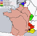
France in 1314.jpg 726 × 1,324; 295 KB
-
France in the 13th Century.png 908 × 1,145; 549 KB
-
C. 1328 France and English Possessions.jpg 1,052 × 1,260; 1.91 MB
-
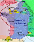
France 1328-hu.svg 423 × 518; 179 KB
-
Francia1328-Shepherd-Simplificado.svg 1,076 × 1,261; 1.28 MB
-
Francia1328.svg 1,076 × 1,261; 3.61 MB
-
Guyenne 1328-en.svg 512 × 627; 43 KB
-
Guyenne 1328-es.svg 988 × 1,124; 615 KB
-
Guyenne 1328-hu.svg 512 × 627; 49 KB
-
Guyenne 1328.svg 423 × 518; 60 KB
-
Shepherd-c-076.jpg 947 × 1,541; 446 KB
-
جوين 1328.png 880 × 1,078; 394 KB
-
France 1330-hu.svg 423 × 518; 76 KB
-
France 1330-nl.svg 423 × 518; 75 KB
-
France 1330.svg 423 × 518; 76 KB
-
Frankryk 1330.svg 423 × 518; 76 KB
-
Guyenne 1330-es.svg 423 × 518; 59 KB
-
Modern history; Europe (1904) (14763412114).jpg 2,040 × 1,800; 886 KB
-
France 1350-es.svg 423 × 518; 183 KB
-
France 1350-hu.svg 423 × 518; 185 KB
-
France 1350.svg 423 × 518; 184 KB
-
C. 1360 Southwestern Europe.jpg 1,469 × 1,248; 1.59 MB
-
Spanish kingdoms 1360.jpg 1,151 × 863; 294 KB
-
France after the Peace of Brétigny 1360 (Johnston).jpg 1,120 × 1,159; 783 KB
-
France in 1429 (Johnston).jpg 2,565 × 2,796; 3.95 MB
-
March of Edward III in 1346.jpg 1,076 × 666; 330 KB
-
Marches of Calais - 1377 (Johnston).jpg 1,079 × 800; 428 KB
-
France1911dev.png 2,046 × 2,780; 3.94 MB
-
Provinces of France 1322-1789.png 2,388 × 2,452; 10.31 MB
-
Agrandissements de la France aux XIVe et XVe siècles.jpeg 591 × 584; 105 KB
-
Apanages-es.svg 1,625 × 2,000; 707 KB
-
Apanages-hu.svg 1,007 × 1,238; 217 KB
-
Apanages.svg 1,007 × 1,238; 216 KB
-
C. 1400 France Ecclesiastical.jpg 3,010 × 3,890; 4.92 MB
-
Début guerre de cent ans-ja.svg 423 × 518; 65 KB
-
France 1328.svg 423 × 518; 179 KB
-
France 1330 ger.svg 423 × 518; 75 KB
-
France 1330-es.svg 423 × 518; 76 KB
-
France 1330.jpg 423 × 515; 243 KB
-
Jaqueries et compagnies ru.svg 423 × 516; 211 KB
-
Jaqueries et compagnies-es.svg 1,603 × 1,966; 515 KB
-
Jaqueries et compagnies-hu.svg 423 × 518; 211 KB
-
Jaqueries et compagnies.svg 423 × 518; 210 KB
-
Le Verdunois XIIIe-XVIe siecle.jpg 1,475 × 1,023; 496 KB
-
Les apanages sous Charles VI.jpeg 498 × 599; 276 KB
-
Map- France at the Treaty of Bretigny (cropped).jpg 961 × 1,134; 302 KB
-
Map- France at the Treaty of Bretigny.jpg 1,107 × 1,389; 384 KB
-
Poscharles le mauvais-es.svg 423 × 518; 186 KB
-
Poscharles le mauvais.svg 423 × 518; 185 KB
-
Pre-1500 map spread.jpg 800 × 764; 258 KB
-
Reconquête Charles V-ja.svg 1,000 × 1,247; 234 KB
-
Rennes - Siège de 1356-1357.svg 379 × 311; 123 KB


