
Category:Maps of Montenegro in the 14th century
English: This category is about the subject of Template:Country data Montenegro 1301-1400 CE: History maps showing all or a substantial part of the territory of Montenegro as it was in the 14th century.
Contemporary old maps belong into: Category:Old maps of Montenegro and its subcategories.
Contemporary old maps belong into: Category:Old maps of Montenegro and its subcategories.
Subcategories
This category has the following 3 subcategories, out of 3 total.
Media in category "Maps of Montenegro in the 14th century"
The following 7 files are in this category, out of 7 total.
-
 1373 Propast Nikole Altomanovica Vojinovica.jpg 1,024 × 1,154; 167 KB
-
 Albanian Principalities, ca. 1390 (modern Albania).png 3,378 × 6,441; 7.96 MB
-
 Bar Ulcinj Skadar i Drivast 1392 - 1421 B.svg 922 × 1,127; 951 KB
-
 Budva 1392 - 1420.svg 1,213 × 852; 874 KB
-
 Realm of Vojislav Vojinović and Nikola Altomanović.png 622 × 798; 59 KB
-
 Srbija gospodari oblasti XIV v.svg 1,600 × 1,200; 205 KB
-
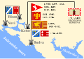
 Zeta Stracimira i Djuradja I Balsica lat.png 596 × 439; 121 KB

.png)


