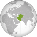
Category:Maps of the Khwarazmian Empire
Jump to navigation
Jump to search
Media in category "Maps of the Khwarazmian Empire"
The following 18 files are in this category, out of 18 total.
-
Historical Atlas of Iran - Plate No. 16 (cropped).jpg 3,983 × 2,786; 1.86 MB
-
Historical Atlas of Iran - Plate No. 16.jpg 4,963 × 3,509; 2 MB
-
Iran-kharazmshahids2.jpg 2,523 × 1,763; 1.4 MB
-
Iszlám világ 1200k.jpg 2,339 × 1,654; 544 KB
-
Khwarazmian dynasty (greatest extent).svg 553 × 553; 273 KB
-
Khwarezmian Empire 1190 - 1220 (AD)-ar.svg 652 × 407; 1.28 MB
-
Khwarezmian Empire 1190 - 1220 (AD)-es.svg 1,801 × 1,373; 2.24 MB
-
Khwarezmian Empire 1190 - 1220 (AD).PNG 620 × 428; 22 KB
-
Khwarezmian Empire 1190 - 1220 (AD).svg 652 × 407; 1.38 MB
-
Khwarezmian Empire 1190 1220-ar.png 620 × 428; 49 KB
-
Khwarezmian Empire 1190 1220-he.png 620 × 373; 30 KB
-
Khwarezmian Empire 1190 1220.png 620 × 428; 30 KB
-
Khwarezmid Empire 1190-1220.png 752 × 591; 38 KB
-
Khwarezmid-empire-1220CE.png 250 × 114; 4 KB
-
Map of the Khwarazmian Empire.png 3,370 × 2,175; 16 MB
-
Империя Хорезмшахов.jpg 899 × 659; 244 KB
-
الدولة الخوارزمية 2014-06-11 01-45.jpg 620 × 428; 70 KB
-
குவாரசமியா.png 620 × 428; 65 KB


