Category:Maps of the Samanid Empire
Jump to navigation
Jump to search
Media in category "Maps of the Samanid Empire"
The following 19 files are in this category, out of 19 total.
-
 Arab world 946 (old Russian).jpg 543 × 268; 68 KB
-
 Asia 900ad.jpg 2,222 × 1,518; 855 KB
-
 Carte Iran 933-fa.svg 973 × 646; 379 KB
-
 DinastíaSamaní819-999.svg 1,040 × 527; 809 KB
-
 Diyaleme.svg 973 × 646; 411 KB
-
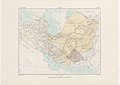 Historical Atlas of Iran - Plate No. 11.jpg 4,963 × 3,509; 2.23 MB
-
 Map of the Samanid amirate at the death of Abd al-Malik I, 961-es.svg 1,603 × 1,127; 6.13 MB
-
 Map of the Samanid amirate at the death of Abd al-Malik I, 961.svg 1,603 × 1,127; 6.89 MB
-
 Map of the Samanid amirate at the death of Nasr II, 943-es.svg 1,603 × 1,127; 6.15 MB
-
 Map of the Samanid amirate at the death of Nasr II, 943.svg 1,603 × 1,127; 6.95 MB
-
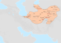
 Persia circa 1000AD-pt.svg 912 × 606; 198 KB
-
 Saman1.jpg 900 × 702; 234 KB
-
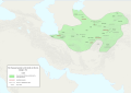
 Samanian - mhk.png 879 × 605; 90 KB
-
 Samanid and Alavid - 316.svg 1,114 × 538; 636 KB
-
 Samanid dynasty (819–999)-ar.png 729 × 568; 125 KB
-
 Samanid dynasty (819–999).GIF 861 × 671; 20 KB
-
 Samanid dynasty.gif 861 × 671; 19 KB
-
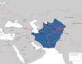
 Samanid Empire (greatest extent).svg 553 × 553; 277 KB
-
 Samanid khorasan 900 ad.jpg 1,309 × 981; 593 KB
.jpg)


-ar.png)
.GIF)

.svg)
