Category:Maps of the Buyid Empire
Jump to navigation
Jump to search
Media in category "Maps of the Buyid Empire"
The following 25 files are in this category, out of 25 total.
-
 Arab world 946 (old Russian).jpg 543 × 268; 68 KB
-
 Arab world before Seljuk invasion (old Russian).jpg 545 × 270; 69 KB
-
 Buyid amirates in the Middle East, ca. 970.svg 1,446 × 1,002; 10.34 MB
-
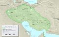
 Buyid Dynasty (greatest extent).svg 553 × 553; 272 KB
-
 Buyid Dynasty 934 1055 (AD).PNG 620 × 428; 20 KB
-
 Buyid Empire Map.jpg 768 × 577; 113 KB
-
 Buyids 970-ar.png 1,321 × 841; 1.07 MB
-
 Buyids 970.png 1,321 × 841; 1.01 MB
-
 Buyids within the Middle East, ca. 970.png 1,202 × 680; 359 KB
-
 Carte Iran 1000-fa.svg 912 × 606; 123 KB
-
 Carte Iran 1000.png 1,093 × 727; 262 KB
-
 DinastíaBuyí934-1055.svg 652 × 407; 92 KB
-
 Diyaleme.svg 973 × 646; 411 KB
-
 Historical Atlas of Iran - Plate No. 13 (cropped).jpg 4,140 × 2,557; 1.77 MB
-
 Historical Atlas of Iran - Plate No. 13.jpg 4,963 × 3,509; 1.93 MB
-
 Iran in 10th century AD.png 1,075 × 710; 248 KB
-
 Map of the Buyids.png 3,196 × 1,840; 13.12 MB
-
 Persia circa 1000AD-ar.svg 912 × 606; 273 KB
-
 Persia circa 1000AD-es.svg 912 × 606; 928 KB
-
 Persia circa 1000AD-pt.svg 912 × 606; 198 KB
-
 Persia circa 1000AD.svg 912 × 606; 185 KB
-
 Spruner-Menke Handatlas 1880 Karte 82.jpg 3,589 × 2,929; 1.13 MB
-
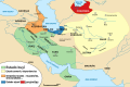
 Voshmgir - Salar - Buye (330).png 424 × 397; 19 KB
-

-
 بۊيئن ٚ قلمرؤ.jpg 768 × 574; 156 KB
.jpg)
.jpg)

.svg)
.PNG)


.jpg)


.png)
.jpg)
