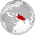
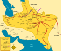
Category:Maps of the Ghaznavid Empire
Jump to navigation
Jump to search
Media in category "Maps of the Ghaznavid Empire"
The following 31 files are in this category, out of 31 total.
-
1030 yılı Gazne Devleti haritası.png 600 × 520; 83 KB
-
Arab world before Seljuk invasion (old Russian).jpg 545 × 270; 69 KB
-
Gaznavidák 1030 map.jpg 2,339 × 1,654; 427 KB
-
Gazneliler Devleti.png 734 × 536; 542 KB
-
Gazneliler.png 550 × 364; 28 KB
-
Ghaznavid Empire (map).jpg 2,241 × 1,282; 498 KB
-
Ghaznavid empire 1100 ad.jpg 1,352 × 794; 875 KB
-
Ghaznavid Empire 975 - 1187 (AD)-ar.PNG 620 × 428; 34 KB
-
Ghaznavid Empire 975 - 1187 (AD).PNG 620 × 428; 20 KB
-
Ghaznavid Empire 975 - 1187 (AD)1.png 620 × 428; 31 KB
-
Ghaznavid Empire.jpg 504 × 210; 29 KB
-
Ghaznavid Empire.png 721 × 722; 258 KB
-
Ghaznavid greatest extent.png 860 × 582; 13 KB
-
Ghaznavid map 1025 ad.jpg 1,354 × 795; 952 KB
-
Ghaznavids (greatest extent).svg 553 × 553; 270 KB
-
Ghaznavids1028.png 1,164 × 658; 27 KB
-
Ghaznevid Empire (map of asia).jpg 300 × 235; 13 KB
-
Historical Atlas of Iran - Plate No. 14.jpg 4,963 × 3,509; 1.93 MB
-
ImperioGaznaví975-1187.svg 2,241 × 1,282; 1.02 MB
-
Iran-ghaznavids (alptekin & saboktekin).jpg 2,511 × 2,467; 1,008 KB
-
Iran-ghaznavids-king mahmoud.jpg 3,621 × 3,044; 1.84 MB
-
Iran-ghaznavids-king masoud.jpg 3,616 × 3,038; 1.6 MB
-
Mahmud of Ghazni-ar.png 2,434 × 2,054; 699 KB
-
Mahmud of Ghazni.svg 2,434 × 2,054; 653 KB
-
Map of the Ghaznavid Empire (drab).png 3,367 × 2,470; 18.34 MB
-
Map of the Ghaznavid Empire.png 3,367 × 2,575; 5.99 MB
-
Mas'ud I of Ghazni.svg 2,434 × 2,054; 427 KB
-
Tabaristan ON THE Qaznavid Empire.PNG 810 × 552; 1.02 MB
-
TE-Gazne devleti (1030)-es.svg 900 × 780; 111 KB
-
TE-Gazne devleti (1030).svg 900 × 780; 174 KB
-
The Ghaznavid Empire at its maximum extent.png 1,296 × 851; 91 KB
Categories:
- Ghaznavid Empire
- Maps of empires
- Maps of the history of Asia by former country
- Maps of the history of Afghanistan
- Maps of India in the 10th century
- Maps of India in the 11th century
- Maps of India in the 12th century
- Maps of the history of Iran
- Maps of the history of Pakistan
- Maps of the history of Tajikistan


