Category:Maps of Khwarezm
Jump to navigation
Jump to search
Subcategories
This category has only the following subcategory.
E
- Maps of the Khwarazmian Empire (18 F)
Media in category "Maps of Khwarezm"
The following 24 files are in this category, out of 24 total.
-
 AfrighidsMap.png 833 × 515; 11 KB
-
 AlashOrda1920.png 1,200 × 978; 70 KB
-
 ApproximatebordersAlashAutonomy.png 1,400 × 1,108; 90 KB
-
 Ar-خوارزم.jpg 746 × 1,024; 251 KB
-
 Aral-u.Saryk.See.png 800 × 1,074; 1.24 MB
-
 Eldiguzids-1175.png 1,122 × 595; 83 KB
-
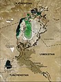 Karte aralsee.jpg 800 × 1,074; 185 KB
-
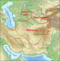 Karte Map Chorasan-Transoxanien-Choresmien.png 589 × 597; 550 KB
-
 Kath und Gurgandsch.jpg 746 × 1,024; 125 KB
-
 Khorasan-Mawaralnahr-Khwarizm.jpg 161 × 103; 36 KB
-
 KhorasanAR.jpg 1,920 × 1,080; 219 KB
-
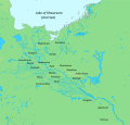
 Khwarazm oasis.jpg 745 × 1,024; 137 KB
-
 Khwarazm under the Sasanians.png 1,321 × 706; 265 KB
-
 Khwarazm.jpg 814 × 1,117; 183 KB
-
 Khwārezm tmo 2017232 lrg.jpg 6,000 × 6,000; 10.08 MB
-
 Khwārezm tmo 2017232.jpg 720 × 480; 169 KB
-
 Map of Khwarazm in the Islamic period, before the Mongol invasion.svg 1,912 × 1,828; 771 KB
-
 Mawara'nnahr, Khwarazm and Greater Khorasan.png 568 × 371; 351 KB
-
 Parthia 001ad-ar.jpg 793 × 652; 645 KB
-
 Parthia 001ad.jpg 793 × 652; 741 KB
-
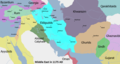
 Persia circa 1000AD-pt.svg 912 × 606; 198 KB
-
 SovietCentralAsia1922ru.svg 1,066 × 869; 241 KB
-
 Джанбас 4 (поселение-стоянка)2.jpg 900 × 932; 224 KB
-
 خوارزم.jpg 746 × 1,024; 134 KB


2.jpg)
