Category:Transport maps of the Democratic Republic of the Congo
Jump to navigation
Jump to search
Countries of Africa: Algeria · Benin · Cape Verde · Democratic Republic of the Congo · Djibouti · Egypt‡ · Eswatini · Ethiopia · Gabon · Ghana · Ivory Coast · Kenya · Liberia · Madagascar · Morocco · Namibia · Niger · Rwanda · Senegal · Sierra Leone · Somalia · South Africa · Sudan · Tanzania · Togo · Tunisia · Uganda · Zambia · Zimbabwe
Limited recognition: Somaliland – Other areas: Réunion
‡: partly located in Africa
Limited recognition: Somaliland – Other areas: Réunion
‡: partly located in Africa
Subcategories
This category has the following 2 subcategories, out of 2 total.
Media in category "Transport maps of the Democratic Republic of the Congo"
The following 3 files are in this category, out of 3 total.
-
 Belgian Congo Railway Network pre-1960.svg 671 × 559; 870 KB
-
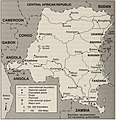
 Congo Transport Map.PNG 1,129 × 987; 170 KB
-
 Transportation System, 1993.jpg 2,108 × 2,172; 1.5 MB
