Category:Maps of cities in the Democratic Republic of the Congo
Jump to navigation
Jump to search
Maps of cities in the Democratic Republic of the Congo.
Subcategories
This category has the following 4 subcategories, out of 4 total.
K
- Maps of Kinshasa (46 F)
- Maps of Kisangani (3 F)
L
- Maps of Lubumbashi (8 F)
Media in category "Maps of cities in the Democratic Republic of the Congo"
The following 8 files are in this category, out of 8 total.
-
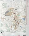
 1952 Luluabourg map txu-oclc-29595290.jpg 7,000 × 6,440; 11.56 MB
-
 1959 Matadi map txu-oclc-55853021.jpg 4,581 × 7,000; 8.3 MB
-
 1980 Likasi map Zaire txu-oclc-71752615.jpg 5,515 × 7,000; 9.78 MB
-
 1981 map Bukavu txu-oclc-55689994.jpg 6,670 × 7,000; 13.47 MB
-
 1982 Goma map Zaire txu-oclc-71754688.jpg 7,000 × 6,447; 14.09 MB
-
 Sketch Plan of Kibumba. (WOMAT-AFR-BEA-207-2).jpg 8,893 × 6,075; 34.86 MB
-
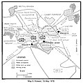 US military map of Kolwezi.jpg 917 × 914; 343 KB
-
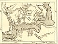 Vivi-matadi.jpg 646 × 485; 385 KB


.jpg)

