Category:Maps of the Cocos (Keeling) Islands
Appearance
Countries of Oceania: Australia · Fiji · Federated States of Micronesia · Kiribati · Marshall Islands · Nauru · New Zealand · Palau · Papua New Guinea · Samoa · Solomon Islands · Tonga · Tuvalu · Vanuatu
Other areas: American Samoa · Clipperton Island · Cocos (Keeling) Islands · Cook Islands · French Polynesia · Guam · Hawaii · New Caledonia · Niue · Norfolk Island · Northern Mariana Islands · Pitcairn Islands · Tokelau · Wallis and Futuna – Partly: British overseas territories · Overseas France · Indonesia · French Southern and Antarctic Lands · United States Minor Outlying Islands
Other areas: American Samoa · Clipperton Island · Cocos (Keeling) Islands · Cook Islands · French Polynesia · Guam · Hawaii · New Caledonia · Niue · Norfolk Island · Northern Mariana Islands · Pitcairn Islands · Tokelau · Wallis and Futuna – Partly: British overseas territories · Overseas France · Indonesia · French Southern and Antarctic Lands · United States Minor Outlying Islands
States of Australia: New South Wales · Queensland · South Australia · Tasmania · Victoria · Western Australia
Internal territories of Australia: Australian Capital Territory · Jervis Bay Territory · Northern Territory
External territories of Australia: Ashmore and Cartier Islands · Australian Antarctic Territory · Christmas Island · Cocos (Keeling) Islands · Coral Sea Islands · Heard Island and McDonald Islands · Norfolk Island
females in Cocos | |||||
| Upload media | |||||
| Instance of |
| ||||
|---|---|---|---|---|---|
| Facet of |
| ||||
| |||||
Subcategories
This category has the following 3 subcategories, out of 3 total.
Pages in category "Maps of the Cocos (Keeling) Islands"
This category contains only the following page.
Media in category "Maps of the Cocos (Keeling) Islands"
The following 36 files are in this category, out of 36 total.
-
13 of 'The Cocos-Keeling Islands' (11201203964).jpg 1,520 × 1,838; 405 KB
-
180 of '(The Geological Observer.)' (11230744965).jpg 1,080 × 1,316; 394 KB
-
20 of 'The Cocos-Keeling Islands' (11108279543).jpg 846 × 862; 110 KB
-
204 of '(The Geological Observer.)' (11232705486).jpg 1,115 × 1,351; 520 KB
-
234 of 'The Geological Observer' (11231021584).jpg 1,315 × 1,418; 484 KB
-
266 of '(A class book of physical geography.)' (11096119445).jpg 600 × 772; 93 KB
-
32 of 'The Cocos-Keeling Islands' (11108867495).jpg 465 × 370; 42 KB
-
41 of 'The Cocos-Keeling Islands' (11200095263).jpg 2,277 × 2,783; 1.1 MB
-
57 of 'The Cocos-Keeling Islands' (11199152826).jpg 1,520 × 1,626; 323 KB
-
Admiralty Chart No 2510 Cocos or Keeling Islands, Indian Ocean, Published 1856.jpg 7,849 × 5,787; 8.57 MB
-
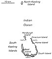
Atoll research bulletin (1994) (20158299740).jpg 3,168 × 1,918; 1.07 MB
-
Atoll research bulletin (1994) (20159719819).jpg 1,214 × 2,998; 497 KB
-
Atoll research bulletin (1994) (20159807219).jpg 2,108 × 2,568; 1,018 KB
-
Atoll research bulletin (1994) (20159825269).jpg 2,158 × 2,562; 1.18 MB
-
Atoll research bulletin (1994) (20159835819).jpg 1,948 × 2,938; 1.08 MB
-
Atoll research bulletin (1994) (20346396375).jpg 2,976 × 2,070; 763 KB
-
Chart of Cocos Keeling Islands.png 872 × 1,179; 498 KB
-
Ck-map.png 329 × 355; 5 KB
-
Cocos (Keeling) Islands-CIA WFB Map (LT version).png 600 × 647; 18 KB
-
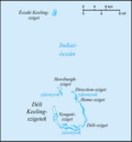
Cocos (Keeling) Islands-CIA WFB Map hu.png 658 × 710; 63 KB
-
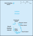
Cocos (Keeling) Islands-CIA WFB Map.png 329 × 355; 5 KB
-
Cocos Islands 1889.jpg 948 × 1,344; 285 KB
-
Cocos(keeling) 76.jpg 885 × 1,023; 141 KB
-
Cosos (Keeling) Islands (Australia) map.png 329 × 355; 6 KB
-
Flag map of Cocos (Keeling) Islands.png 1,920 × 1,080; 30 KB
-
Ka Cocos (Keeling) Islands-CIA WFB Map.png 329 × 355; 4 KB
-
Keeling be.png 329 × 355; 10 KB
-
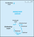
Kokosinseln.png 329 × 355; 16 KB
-
Lingiari division map.png 207 × 111; 2 KB
-
PAT - Cocos (Keeling) Islands.gif 800 × 1,035; 34 KB
-
The physical atlas - South Keeling Islands.jpg 1,079 × 1,736; 193 KB
-
World Factbook (1990) Cocos (Keeling) Islands.jpg 488 × 553; 34 KB
-
Wyspy Kokosowe.png 1,774 × 2,739; 1.88 MB


