Category:Travel maps of the Cocos (Keeling) Islands
Jump to navigation
Jump to search
States of Australia: New South Wales · Queensland · South Australia · Tasmania · Victoria · Western Australia
Internal territories of Australia: Australian Capital Territory · Northern Territory
External territories of Australia: Christmas Island · Cocos (Keeling) Islands · Norfolk Island
Internal territories of Australia: Australian Capital Territory · Northern Territory
External territories of Australia: Christmas Island · Cocos (Keeling) Islands · Norfolk Island
Countries of Oceania: Australia · Fiji · Federated States of Micronesia · Kiribati · Marshall Islands · Nauru · New Zealand · Papua New Guinea · Samoa
Other areas: American Samoa · Cocos (Keeling) Islands · Cook Islands · French Polynesia · Guam · Hawaii · New Caledonia · Niue · Norfolk Island · Northern Mariana Islands · Pitcairn Islands · Tokelau · Wallis and Futuna – Partly: Indonesia
Other areas: American Samoa · Cocos (Keeling) Islands · Cook Islands · French Polynesia · Guam · Hawaii · New Caledonia · Niue · Norfolk Island · Northern Mariana Islands · Pitcairn Islands · Tokelau · Wallis and Futuna – Partly: Indonesia
Media in category "Travel maps of the Cocos (Keeling) Islands"
The following 5 files are in this category, out of 5 total.
-
 Cocos-keeling-islands-map-es.svg 792 × 946; 1.46 MB
-
 Cocos-keeling-islands-map.png 3,000 × 3,583; 1.56 MB
-
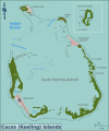 Cocos-keeling-islands-map.svg 792 × 946; 1.46 MB
-
 Pulu Keeling NP map.png 1,899 × 1,582; 564 KB
-
 Pulu Keeling NP map.svg 750 × 625; 935 KB


