Category:Maps of the Coral Sea Islands
Jump to navigation
Jump to search
States of Australia: New South Wales · Queensland · South Australia · Tasmania · Victoria · Western Australia
Internal territories of Australia: Australian Capital Territory · Jervis Bay Territory · Northern Territory
External territories of Australia: Ashmore and Cartier Islands · Australian Antarctic Territory · Christmas Island · Cocos (Keeling) Islands · Coral Sea Islands · Heard Island and McDonald Islands · Norfolk Island
Subcategories
This category has the following 2 subcategories, out of 2 total.
L
Pages in category "Maps of the Coral Sea Islands"
This category contains only the following page.
Media in category "Maps of the Coral Sea Islands"
The following 13 files are in this category, out of 13 total.
-
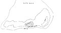 Cato Reef.jpg 3,428 × 1,845; 223 KB
-
 Coral sea hu.jpg 1,976 × 1,379; 595 KB
-
 Coral Sea.jpg 694 × 517; 89 KB
-
 Coral sea.jpg 1,976 × 1,379; 362 KB
-
 CORALSEA.png 580 × 616; 11 KB
-
 Flag map of Coral Sea Islands.png 1,222 × 1,710; 38 KB
-
 Frederick Reef Chart1.jpg 693 × 1,172; 111 KB
-
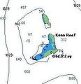 Kenn reef.jpg 211 × 219; 9 KB
-
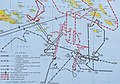
 Pacific War - Coral Sea and Midway - Map.jpg 1,260 × 961; 209 KB
-
 PacificTheaterAug1942.jpg 1,199 × 873; 256 KB
-
 The Australian zoologist (1934) (20163567039).jpg 3,120 × 2,308; 1.05 MB
-
 The Australian zoologist (1934) (20323954256).jpg 3,216 × 2,432; 1.27 MB
-
 Wyspy Morza Koralowego.png 2,627 × 3,238; 432 KB


_(20163567039).jpg)
_(20323954256).jpg)
