Category:Maps of Ashmore and Cartier Islands
Jump to navigation
Jump to search
States of Australia: New South Wales · Queensland · South Australia · Tasmania · Victoria · Western Australia
Internal territories of Australia: Australian Capital Territory · Jervis Bay Territory · Northern Territory
External territories of Australia: Ashmore and Cartier Islands · Australian Antarctic Territory · Christmas Island · Cocos (Keeling) Islands · Coral Sea Islands · Heard Island and McDonald Islands · Norfolk Island
Wikimedia category | |||||
| Upload media | |||||
| Instance of | |||||
|---|---|---|---|---|---|
| Category combines topics | |||||
| Ashmore and Cartier Islands | |||||
external territory of Australia in the Indian Ocean .jpg)  | |||||
| Instance of | |||||
| Location | AUS | ||||
| Located in or next to body of water | |||||
| Highest judicial authority |
| ||||
| Inception |
| ||||
| Population |
| ||||
| Area |
| ||||
| Elevation above sea level |
| ||||
 | |||||
Subcategories
This category has only the following subcategory.
L
Pages in category "Maps of Ashmore and Cartier Islands"
This category contains only the following page.
Media in category "Maps of Ashmore and Cartier Islands"
The following 14 files are in this category, out of 14 total.
-
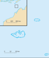
 06-001a Ashmore Reef.png 1,536 × 904; 247 KB
-
 Ashmore and Cartier Islands-CIA WFB Map-ja.png 328 × 355; 6 KB
-
 Ashmore and Cartier Islands-CIA WFB Map.png 328 × 355; 6 KB
-
 Ashmore i Cartier.png 805 × 471; 88 KB
-
 Ashmore.png 330 × 355; 9 KB
-
 ASHMOREANDCARTIER.png 570 × 374; 8 KB
-
 AshmoreandCartierIslands.png 328 × 355; 11 KB
-
 Ashmorefr.png 295 × 351; 4 KB
-
 Ashmorenotext.png 295 × 352; 3 KB
-
 At-map.gif 328 × 355; 8 KB
-
 Flag map of Ashmore and Cartier Islands.png 1,039 × 496; 3 KB
-
 Map of Ashmore and Cartier Islands-hr.png 395 × 471; 44 KB
-
 Map of Ashmore and Cartier Islands-hu.png 328 × 355; 9 KB
-
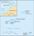
 World Factbook (1990) Ashmore and Cartier Islands.jpg 589 × 452; 27 KB


_Ashmore_and_Cartier_Islands.jpg)