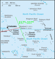
Category:Maps of Kiribati
Appearance
Countries of Oceania: Australia · Fiji · Federated States of Micronesia · Kiribati · Marshall Islands · Nauru · New Zealand · Palau · Papua New Guinea · Samoa · Solomon Islands · Tonga · Tuvalu · Vanuatu
Other areas: American Samoa · Clipperton Island · Cocos (Keeling) Islands · Cook Islands · French Polynesia · Guam · Hawaii · New Caledonia · Niue · Norfolk Island · Northern Mariana Islands · Pitcairn Islands · Tokelau · Wallis and Futuna – Partly: British overseas territories · Overseas France · Indonesia · French Southern and Antarctic Lands · United States Minor Outlying Islands
Other areas: American Samoa · Clipperton Island · Cocos (Keeling) Islands · Cook Islands · French Polynesia · Guam · Hawaii · New Caledonia · Niue · Norfolk Island · Northern Mariana Islands · Pitcairn Islands · Tokelau · Wallis and Futuna – Partly: British overseas territories · Overseas France · Indonesia · French Southern and Antarctic Lands · United States Minor Outlying Islands
Wikimedia category | |||||
| Upload media | |||||
| Instance of | |||||
|---|---|---|---|---|---|
| Category combines topics | |||||
 | |||||
Subcategories
This category has the following 15 subcategories, out of 15 total.
- Maps of the Gilbert Islands (58 F)
*
F
- Flag maps of Kiribati (6 F)
L
O
- Old maps of Kiribati (14 F)
P
S
Pages in category "Maps of Kiribati"
This category contains only the following page.
Media in category "Maps of Kiribati"
The following 13 files are in this category, out of 13 total.
-
19 Map of Banaba, Kiribati.jpg 768 × 994; 360 KB
-
Banaba Island - Marplot Map with Contours (1-20,000).jpg 1,240 × 904; 429 KB
-
ECDM 20140313 World Events.pdf 1,625 × 1,125; 250 KB
-
International Date Line (Kiribati region).svg 4,477 × 3,469; 1.05 MB
-
Kiribati DNI Solar-resource-map GlobalSolarAtlas World-Bank-Esmap-Solargis.png 1,842 × 1,842; 327 KB
-
Kiribati GHI Solar-resource-map GlobalSolarAtlas World-Bank-Esmap-Solargis.png 1,842 × 1,842; 320 KB
-
Kiribati Population Density, 2000 (5457015011).jpg 2,494 × 3,212; 597 KB
-
Kiribati Population Density, 2000 (6172441176).jpg 2,324 × 3,161; 562 KB
-
Kiribati-map-AE.png 300 × 322; 61 KB
-
Kr-map.gif 330 × 354; 11 KB
-
Pacific Ocean laea Oceanian countries map.jpg 1,165 × 1,070; 542 KB
-
Standard Time Zones (Oceania region).svg 354 × 259; 2.85 MB


