Category:Maps of protected areas of the United States
Jump to navigation
Jump to search
Countries of the Americas: Brazil · Canada · Colombia · Costa Rica · Ecuador · Peru · United States of America · Uruguay
Subcategories
This category has the following 35 subcategories, out of 35 total.
*
B
- Maps of Blue Ridge Parkway (33 F)
C
G
- Maps of Great Falls Park (10 F)
M
N
R
- Maps of Rock Creek Park (23 F)
V
Media in category "Maps of protected areas of the United States"
The following 45 files are in this category, out of 45 total.
-
BLM Wilderness Study Areas.jpeg 478 × 600; 61 KB
-
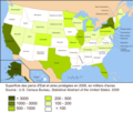
Carte aires protégées USA 2006.png 2,500 × 2,116; 874 KB
-
Cascade Range map protected areas map-fr.svg 403 × 693; 3.63 MB
-
Cascade Range map protected areas map-it.svg 403 × 693; 3.14 MB
-
City of Rocks National Reserve map 2006.07.png 3,303 × 3,358; 2.45 MB
-
Cranberry Wilderness Map.jpg 858 × 1,384; 690 KB
-
DSC05722 (21895436759).jpg 5,456 × 3,632; 5.69 MB
-
McLoughlin House map 2003.jpg 400 × 400; 35 KB
-
McLoughlin House map 2005.png 172 × 172; 12 KB
-
Gateway National Recreation Area map de.pdf 1,275 × 1,650; 1.88 MB
-
George Washington Memorial Parkway - Reference Map.jpg 8,310 × 6,462; 5.87 MB
-
GooseneckMeandersUtahTopo1.jpg 3,757 × 2,876; 7.09 MB
-
GSENM Brochure Final CYMK Devils Garden circled.jpg 2,198 × 1,682; 1.54 MB
-
Guilford Courthouse Park - new map.jpg 1,498 × 1,115; 206 KB
-
Guilford Courthouse Park - new map.pdf 1,616 × 1,204; 164 KB
-
Guilford Courthouse Park - old map.jpg 1,207 × 686; 154 KB
-
Guilford Courthouse Park - old map.pdf 1,293 × 735; 33 KB
-
HAFOmap.png 2,294 × 2,672; 532 KB
-
Joseph Canyon Map.gif 312 × 365; 25 KB
-
Kern River Preserve and area map.jpg 924 × 1,164; 245 KB
-
Konza Prairie USGS Topo Map.jpg 5,536 × 4,075; 5.29 MB
-
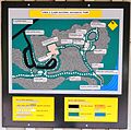
Map of Lewis and Clark National Historic Park.JPG 2,120 × 2,101; 1.58 MB
-
Lost Creek Wilderness location in Colorado.png 3,500 × 2,533; 3.37 MB
-
Makah Reservation Location in WA.png 680 × 466; 612 KB
-
Malheurmap.pdf 1,200 × 1,275; 359 KB
-
Map of Ebey's Landing National Historical Reserve.jpg 2,031 × 1,684; 1.02 MB
-
Map of memorial.JPG 2,631 × 3,680; 3.97 MB
-
MapOfCascadiaOregonUSA.png 1,178 × 926; 1.41 MB
-
Master plan revised1.gif 2,001 × 1,112; 697 KB
-
MNRR-Map2012-05242012.JPG 1,641 × 811; 190 KB
-
Mount St. HelensNational Volcanic Monument map (2012).pdf 1,650 × 2,550; 1.16 MB
-
Mount St. HelensNational Volcanic Monument map (2019).pdf 1,650 × 2,250; 2.91 MB
-
Mshrec.png 1,275 × 1,650; 460 KB
-
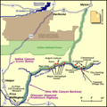
NineMileCanyon map.png 400 × 400; 28 KB
-
Okefenokeelocatormap.png 600 × 600; 161 KB
-
Oregon Caves Cave Map.png 1,596 × 2,112; 781 KB
-
Pine Grove Furnace.png 1,044 × 273; 196 KB
-
Popi map.jpg 1,021 × 781; 163 KB
-
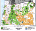
Public land oregon 1996.png 1,572 × 1,366; 3.48 MB
-
Rincon Mountain District map.png 1,599 × 934; 344 KB
-
Mulholland Corridor.jpg 1,261 × 855; 800 KB
-
Thomas stone nhs map.jpg 1,204 × 818; 151 KB
-
US-national-forest-service-lands.png 859 × 540; 110 KB
-
VermilionCliffsMap.jpg 500 × 658; 62 KB
-
Map-of-Yukon-Charley-Rivers-National-Preserve.png 1,207 × 1,029; 1.45 MB

