Category:Maps of Golden Gate National Recreation Area
Jump to navigation
Jump to search
English: Maps of Golden Gate National Recreation Area
Wikimedia category | |||||
| Upload media | |||||
| Instance of | |||||
|---|---|---|---|---|---|
| Category combines topics | |||||
| Golden Gate National Recreation Area | |||||
United States national park in California  | |||||
| Instance of | |||||
| Location | San Francisco Bay Area, California, Pacific States Region | ||||
| Operator | |||||
| IUCN protected areas category | |||||
| Inception |
| ||||
| Area |
| ||||
| Visitors per year |
| ||||
| official website | |||||
 | |||||
Media in category "Maps of Golden Gate National Recreation Area"
The following 36 files are in this category, out of 36 total.
-
 Wpdms usgs photo point reyes large.jpg 300 × 280; 34 KB
-
 Map of Golden Gate National Recreation Area Camping Sites.png 626 × 709; 325 KB
-
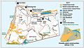
 Map of Golden Gate National Recreation Area.png 1,234 × 1,592; 239 KB
-
 Map-goga.jpg 567 × 200; 15 KB
-
 Milagra Ridge Trail Map (2016).pdf 1,650 × 1,275; 923 KB
-
 Mori-Point-trail-map 2016.pdf 1,650 × 1,275; 1.87 MB
-
 NPS crissy-field-map.jpg 3,629 × 2,211; 1,000 KB
-
 NPS fort-baker-accessible-walking-tour-map.jpg 1,680 × 1,020; 362 KB
-
 NPS fort-baker-map.jpg 1,628 × 1,962; 520 KB
-
 NPS fort-baker-walking-tour-map.jpg 1,680 × 1,020; 328 KB
-
 NPS fort-mason-map.gif 1,438 × 1,709; 291 KB
-
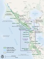
 NPS golden-gate-detail-map.jpg 3,852 × 5,028; 1.98 MB
-
 NPS golden-gate-detail-map.pdf 2,512 × 3,279; 1.49 MB
-
 NPS golden-gate-map-north.jpg 4,236 × 2,673; 1.17 MB
-
 NPS golden-gate-map-south.jpg 3,291 × 4,666; 1.17 MB
-
 NPS golden-gate-map.jpg 1,476 × 1,976; 477 KB
-
 NPS golden-gate-map.pdf 762 × 1,020; 585 KB
-
 NPS golden-gate-national-recreation-area-map.jpg 1,528 × 2,035; 421 KB
-
 NPS golden-gate-national-recreation-area-map.pdf 654 × 870; 2.62 MB
-
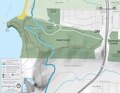
 NPS lands-end-detail-map.gif 2,356 × 1,373; 318 KB
-
 NPS lands-end-map-grayscale.gif 3,175 × 1,909; 722 KB
-
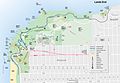 NPS lands-end-map.jpg 2,088 × 1,442; 350 KB
-
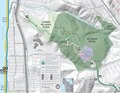
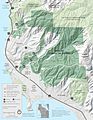
 NPS marin-headlands-detail-map.jpg 1,628 × 1,962; 417 KB
-
 NPS marin-headlands-map.jpg 3,293 × 1,932; 1.32 MB
-
 NPS milagra-ridge-map.jpg 1,980 × 1,530; 525 KB
-
 NPS mori-point-trail-map.jpg 2,200 × 1,700; 430 KB
-
 NPS muir-beach.jpg 1,532 × 1,189; 298 KB
-
 NPS phleger-estate-trail-map.jpg 2,200 × 1,700; 714 KB
-
 NPS presidio-map-grayscale.jpg 4,250 × 2,524; 1.33 MB
-
 NPS presidio-map.jpg 4,250 × 2,602; 1.68 MB
-
 NPS presidio-vegetation-map.jpg 2,032 × 1,176; 368 KB
-
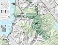
 NPS rancho-corral-de-tierra-map.jpg 2,100 × 2,700; 1.05 MB
-
 NPS stinson-beach-map.jpg 910 × 832; 76 KB
-
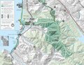
 NPS sweeney-ridge-map.jpg 2,200 × 1,700; 827 KB
-
 Sweeney-Ridge-trail-map-2016.pdf 1,650 × 1,275; 5.32 MB
-
 Wpdms usgs photo point reyes large 2.jpg 300 × 280; 16 KB


