Category:Maps of Rock Creek Park
Jump to navigation
Jump to search
English: Maps of Rock Creek Park
Wikimedia category | |||||
| Upload media | |||||
| Instance of | |||||
|---|---|---|---|---|---|
| Category combines topics | |||||
| Rock Creek Park | |||||
urban park in Washington, D.C.   | |||||
| Instance of | |||||
| Named after | |||||
| Location | Northwest, Washington, D.C., District of Columbia | ||||
| Located in or next to body of water | |||||
| Architect |
| ||||
| Owned by | |||||
| Operator |
| ||||
| Maintained by |
| ||||
| Has part(s) |
| ||||
| Heritage designation |
| ||||
| IUCN protected areas category | |||||
| Inception |
| ||||
| Area |
| ||||
| Elevation above sea level |
| ||||
| Visitors per year |
| ||||
| official website | |||||
 | |||||
Media in category "Maps of Rock Creek Park"
The following 23 files are in this category, out of 23 total.
-

-

-
 Beach Drive Segments 2 and 3 Detour (11175443-1dd8-b71b-0be4-98ace3272912).jpg 3,300 × 2,550; 4.1 MB
-
 Beach Drive Segments 2 and 3 Detour With Instructions (116703dc-1dd8-b71b-0b7e-4ae21b272fb9).jpg 10,200 × 6,600; 5.67 MB
-

-

-

-
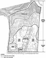
 Historic Period Plan of Montrose Park, 1919 (357e5e5f-f3c6-c08b-c045-9d3b2083a3e7).jpg 1,001 × 1,300; 221 KB
-
 Map of Kenilworth Aquatic Gardens (b9dac1c9-1dd8-b71b-0b1a-a18e60385e4e).jpg 1,650 × 1,275; 322 KB
-

-
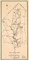 Map of Rock Creek Park - December 1911 - (Washington D.C.) LOC 88693048.jpg 2,688 × 5,588; 2.05 MB
-
 Map of Rock Creek Park - NARA - 137929026.jpg 5,816 × 16,800; 7.12 MB
-
-
 NPS potomac-river-gorge-map.pdf 843 × 1,772; 220 KB
-
 NPS rock-creek-bicycle-map.jpg 1,036 × 1,592; 265 KB
-
 NPS rock-creek-boulder-bridge-trail-map.jpg 1,504 × 1,092; 355 KB
-
 NPS rock-creek-nature-center-trails-map.jpg 1,616 × 1,147; 383 KB
-
 NPS rock-creek-park-elevation-map.gif 1,218 × 1,024; 108 KB
-
 NPS rock-creek-park-geologic-map.jpg 2,631 × 3,258; 1.09 MB
-
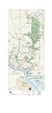
 NPS rock-creek-park-map.gif 1,739 × 3,976; 1.1 MB
-
 NPS rock-creek-park-map.pdf 1,304 × 2,981; 585 KB
-
 Rock Creek Park map.jpg 826 × 2,246; 744 KB
-
 Rock Creek Park, Washington, D.C. LOC 98688148.jpg 5,216 × 7,203; 5.43 MB
.jpg)
.jpg)
.jpg)
.jpg)
.jpg)
.jpg)
.jpg)
.jpg)
.jpg)
.jpg)
_LOC_88693048.jpg)
.jpg)


