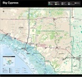
Category:Maps of Big Cypress National Preserve
Jump to navigation
Jump to search
English: Maps of Big Cypress National Preserve
Wikimedia category | |||||
| Upload media | |||||
| Instance of | |||||
|---|---|---|---|---|---|
| Category combines topics | |||||
| Big Cypress National Preserve | |||||
729,000-acre area in Florida (US) managed by the National Park Service | |||||
| Instance of | |||||
| Location | Monroe County, Florida | ||||
| Visitor center |
| ||||
| Operator | |||||
| Heritage designation |
| ||||
| IUCN protected areas category | |||||
| Visitors per year |
| ||||
| official website | |||||
 | |||||
Media in category "Maps of Big Cypress National Preserve"
The following 17 files are in this category, out of 17 total.
-
Jetportimpact 1 1.jpg 728 × 983; 1.59 MB
-
NPS big-cypress-bear-island-orv-map.jpg 1,931 × 925; 220 KB
-
NPS big-cypress-burns-lake-campground-map.gif 2,066 × 2,953; 504 KB
-
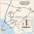
NPS big-cypress-canoe-trails.gif 1,500 × 1,500; 228 KB
-
NPS big-cypress-canoe-trails.pdf 1,800 × 1,800; 604 KB
-
NPS big-cypress-corn-dance-orv-map.gif 1,669 × 2,499; 326 KB
-
NPS big-cypress-geologic-map.gif 2,468 × 2,844; 776 KB
-
NPS big-cypress-loop-road-map.jpg 1,369 × 1,062; 189 KB
-
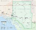
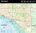
NPS big-cypress-map.jpg 3,337 × 2,841; 1.06 MB
-
NPS big-cypress-map.pdf 2,502 × 2,129; 5.03 MB
-
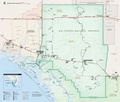
NPS big-cypress-national-preserve-map (cropped).jpg 3,203 × 2,628; 1.56 MB
-
NPS big-cypress-national-preserve-map.jpg 3,203 × 2,920; 1.54 MB
-
NPS big-cypress-national-preserve-map.pdf 2,529 × 2,389; 759 KB
-
NPS big-cypress-stairstep-orv-map.gif 2,570 × 1,814; 276 KB
-
NPS big-cypress-turner-river-orv-map.gif 1,703 × 2,499; 449 KB
-
NPS big-cypress-unit-map.jpg 2,378 × 2,838; 614 KB
-
South Florida Big Cypress Swamp.jpg 1,000 × 1,069; 116 KB


