Category:Maps of Wrangell-St. Elias National Park and Preserve
Jump to navigation
Jump to search
United States national parks: Acadia · American Samoa · Arches · Badlands · Big Bend · Biscayne · Black Canyon of the Gunnison · Bryce Canyon · Canyonlands · Capitol Reef · Carlsbad Caverns · Channel Islands · Congaree · Crater Lake · Cuyahoga Valley · Death Valley · Denali · Dry Tortugas · Everglades · Gateway Arch · Gates of the Arctic · Glacier · Glacier Bay · Grand Canyon · Grand Teton · Great Basin · Great Smoky Mountains · Guadalupe Mountains · Haleakalā · Hawaii Volcanoes · Hot Springs · Indiana Dunes · Isle Royale · Joshua Tree · Kenai Fjords · Kings Canyon · Kobuk Valley · Lake Clark · Lassen Volcanic · Mammoth Cave · Mesa Verde · Mount Rainier · North Cascades · Olympic · Petrified Forest · Pinnacles · Redwood · Rocky Mountain · Saguaro · Sequoia · Shenandoah · Theodore Roosevelt · Virgin Islands · Voyageurs · White Sands · Wind Cave · Wrangell-St. Elias · Yellowstone · Yosemite · Zion
English: Maps of Wrangell–St. Elias National Park and Preserve
Wikimedia category | |||||
| Upload media | |||||
| Instance of | |||||
|---|---|---|---|---|---|
| Category combines topics | |||||
| Wrangell–St. Elias National Park and Preserve | |||||
largest United States national park and national preserve in south-central Alaska  | |||||
| Instance of | |||||
| Part of | |||||
| Location |
| ||||
| Operator | |||||
| Heritage designation |
| ||||
| IUCN protected areas category | |||||
| Inception |
| ||||
| Highest point | |||||
| Area |
| ||||
| Visitors per year |
| ||||
| official website | |||||
 | |||||
Subcategories
This category has the following 2 subcategories, out of 2 total.
Media in category "Maps of Wrangell-St. Elias National Park and Preserve"
The following 11 files are in this category, out of 11 total.
-
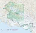
 Map of Wrangell-St. Elias National Park.jpg 3,032 × 2,721; 3.25 MB
-
 McCarthy Road.svg 772 × 543; 560 KB
-
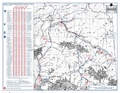
 NPS wrangell-st-elias-alaska-campgrounds-map.jpg 3,520 × 2,720; 2.52 MB
-
 NPS wrangell-st-elias-alaska-campgrounds-map.pdf 3,300 × 2,550; 2.02 MB
-
 NPS wrangell-st-elias-boreal-trail-map.gif 910 × 1,105; 143 KB
-
 NPS wrangell-st-elias-cabin-airstrip-map.jpg 1,404 × 1,282; 591 KB
-
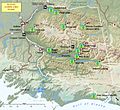
 NPS wrangell-st-elias-map.jpg 3,026 × 2,742; 2.19 MB
-
 NPS wrangell-st-elias-map.pdf 2,520 × 2,285; 4.66 MB
-
 NPS wrangell-st-elias-mccarthy-road-map.jpg 1,318 × 938; 326 KB
-
 NPS wrangell-st-elias-nabesna-road-map.jpg 1,344 × 1,023; 441 KB
-
 Wrangell Mountains.jpg 512 × 379; 68 KB


