
Category:Wrangell-St. Elias National Park and Preserve
United States national parks: Acadia · American Samoa · Arches · Badlands · Big Bend · Biscayne · Black Canyon of the Gunnison · Bryce Canyon · Canyonlands · Capitol Reef · Carlsbad Caverns · Channel Islands · Congaree · Crater Lake · Cuyahoga Valley · Death Valley · Denali · Dry Tortugas · Everglades · Gateway Arch · Gates of the Arctic · Glacier · Glacier Bay · Grand Canyon · Grand Teton · Great Basin · Great Sand Dunes · Great Smoky Mountains · Guadalupe Mountains · Haleakalā · Hawaii Volcanoes · Hot Springs · Indiana Dunes · Isle Royale · Joshua Tree · Katmai · Kenai Fjords · Kings Canyon · Kobuk Valley · Lake Clark · Lassen Volcanic · Mammoth Cave · Mesa Verde · Mount Rainier · New River Gorge · North Cascades · Olympic · Petrified Forest · Pinnacles · Redwood · Rocky Mountain · Saguaro · Sequoia · Shenandoah · Theodore Roosevelt · Virgin Islands · Voyageurs · White Sands · Wind Cave · Wrangell-St. Elias · Yellowstone · Yosemite · Zion
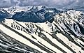
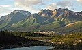
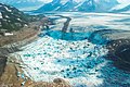
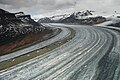
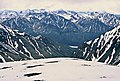
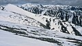
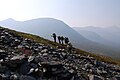
English: Wrangell-St. Elias National Park and Preserve is the National Park Service's largest park. It is located in eastern-central Alaska, and is approximately 13.2 million acres in size. There are only two short roads into the park, so most access is on foot, by ATV, or by plane.
largest United States national park and national preserve in south-central Alaska  | |||||
| Upload media | |||||
| Instance of | |||||
|---|---|---|---|---|---|
| Part of | |||||
| Location | |||||
| Operator | |||||
| Heritage designation |
| ||||
| IUCN protected areas category | |||||
| Inception |
| ||||
| Highest point | |||||
| Area |
| ||||
| Visitors per year |
| ||||
| official website | |||||
 | |||||
Subcategories
This category has the following 22 subcategories, out of 22 total.
Pages in category "Wrangell-St. Elias National Park and Preserve"
This category contains only the following page.
Media in category "Wrangell-St. Elias National Park and Preserve"
The following 87 files are in this category, out of 87 total.
-
 1997- - 12 yrd pre-fire (28209561642).jpg 513 × 750; 91 KB
-
 1998- 11 yrs pre-fire (27697865193).jpg 498 × 728; 102 KB
-
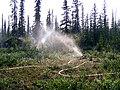
 2009 Summer Season Creek (09b8bb39-1dd8-b71c-071c-c8d083b864e4).jpg 4,752 × 3,168; 10.98 MB
-
 2009- 1 mo post-fire (27697859393).jpg 572 × 750; 146 KB
-
 2009- 1 mo post-fire (27697880743).jpg 488 × 650; 130 KB
-
 2009- 1 month post-fire (27697865123).jpg 549 × 718; 126 KB
-
 2009-5 days pre-fire (27697371834).jpg 488 × 650; 140 KB
-
 2010- 1 year post-fire (28209561492).jpg 572 × 750; 133 KB
-
 2010- 1 yr post-fire (27697864993).jpg 556 × 728; 126 KB
-
 2010- 1 yr post-fire (27697880643).jpg 487 × 650; 129 KB
-

-
 Alaska Wrangell St Elias.jpg 1,302 × 827; 894 KB
-
 Backpackers' camp, Wrangel-St.Elias NP.jpg 2,256 × 1,496; 1.65 MB
-
 Bonanza Peak and Kennecott.jpg 2,818 × 1,716; 1.27 MB
-
 CellularConfinementSystem-Wood.jpg 300 × 187; 10 KB
-
 Cessna 185 at Glacier Creek Strip (03bb8555-1dd8-b71c-0785-f6c5d412dd40).jpg 1,200 × 798; 559 KB
-
 Confluence of Kennicott & Nizina rivers (28250475499).jpg 3,745 × 5,617; 10.39 MB
-
 Dixie Pass Rock Creek.jpeg 1,290 × 855; 778 KB
-
 Donoho Basin.jpg 5,760 × 3,840; 11.64 MB
-
 Double-alaskan-rainbow-airbrushed.jpg 1,919 × 1,008; 1.41 MB
-
 Double-alaskan-rainbow.jpg 1,919 × 1,008; 2.25 MB
-
 Exploring the alpine terrain around Bremner (106ca56e-538a-47f6-8608-41c35c67a655).jpg 5,590 × 3,691; 14.91 MB
-

-
 Glacier Features Jökulhlaup, Iceberg Lake (32238680140).jpg 1,792 × 1,200; 1.84 MB
-
 Iceberg lake on the Russell Glacier.jpg 5,760 × 3,840; 12.76 MB
-
 Kennecott Mill and Railroad Depot (3b78d457-1dd8-b71c-0703-42bb39d54fa3).JPG 2,592 × 1,944; 1.83 MB
-
 Kennecott Mill site and Bonanza Peak.jpg 1,984 × 1,036; 2.89 MB
-
-
 Kennecott Mines National Historic Landmark historical marker for the CR&NW.jpg 5,312 × 2,988; 3.79 MB
-
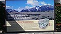
 Kennecott Mines National Historic Landmark marker for the concentration mill schematic.jpg 2,988 × 5,312; 4.02 MB
-
 Kennecott Mines National Historic Landmark marker for the concentration mill.jpg 2,988 × 5,312; 3.81 MB
-
 Kennecott Mines National Historic Landmark marker for the flotation plant.jpg 2,988 × 5,312; 3.61 MB
-
 Kennecott Mines National Historic Landmark marker for the geologic outcrop.jpg 5,312 × 2,988; 5.34 MB
-
 Kennecott Mines National Historic Landmark marker for the leaching plant.jpg 2,988 × 5,312; 3.92 MB
-
 Kennecott Mines National Historic Landmark marker for the mill town.jpg 5,312 × 2,988; 5.55 MB
-
 Kennecott Mines National Historic Landmark marker for the mine shafts.jpg 5,312 × 2,988; 3.56 MB
-
 Kennecott Mines National Historic Landmark marker for the ore body.jpg 5,312 × 2,988; 3.5 MB
-
 Kennecott Mines National Historic Landmark mine tramway ore car.jpg 2,988 × 5,312; 3.79 MB
-

-
 LeeReininghaus (40658771652).jpg 4,672 × 3,104; 9.72 MB
-
 LocMap Wrangell Saint Elias National Park.png 280 × 183; 22 KB
-
 Looking up the Nizina Glacier towards the start.jpg 1,200 × 798; 705 KB
-
 Looking up the Nizina Glacier.jpg 798 × 1,200; 628 KB
-
 Medial Moraines of Nizina Glacier.jpg 1,200 × 847; 813 KB
-
-
-
-
-
 Mount Blackburn in the clouds.jpg 1,650 × 1,168; 2.33 MB
-
 Mount Wrangell as seen from Chitina Airport.jpg 5,312 × 2,988; 4.31 MB
-
 Mt. Blackburn.jpg 5,055 × 3,370; 9.41 MB
-
 Nizina Lake at the base of the Glacier.jpg 1,200 × 798; 620 KB
-
 Nizina Lake w-icebergs.jpg 798 × 1,200; 578 KB
-
 Old route to the Bonanza Mine.jpg 5,479 × 3,653; 11.93 MB
-
 Parque nacional y reserva Wrangell-San Elías, Alaska, Estados Unidos, 2017-08-22, DD 121.jpg 7,285 × 4,084; 7.99 MB
-
 Parque nacional y reserva Wrangell-San Elías, Alaska, Estados Unidos, 2017-08-24, DD 02.jpg 8,688 × 3,208; 7.92 MB
-
 Parque nacional y reserva Wrangell-San Elías, Alaska, Estados Unidos, 2017-08-24, DD 10.jpg 8,263 × 5,509; 9.75 MB
-
 Parque nacional y reserva Wrangell-San Elías, Alaska, Estados Unidos, 2017-08-24, DD 11.jpg 8,610 × 3,460; 8.98 MB
-
 Rain in the Wrangell Mountains.jpg 5,760 × 3,840; 10.65 MB
-
 Setting up camp near Bremner (26156198868).jpg 5,675 × 3,783; 11.58 MB
-
 Smoke Chakina River 09 (02556ddd-1dd8-b71b-0b17-8d4f7479baf7).jpg 540 × 720; 58 KB
-
 Sweeping Curve of the Nizina Glacier.jpg 1,200 × 798; 760 KB
-
 The remains of the Jumbo Mine.jpg 5,533 × 3,689; 10.62 MB
-
 The Wrangells and Tanada Peak (30646183725).jpg 4,099 × 2,733; 5.99 MB
-
 Ultima Thule Peak, Alaska.jpg 3,225 × 2,234; 5.4 MB
-
 Williams Peak Nizina River valley.jpg 1,167 × 620; 633 KB
-
 Williams Peak of Dan Creek area.jpg 2,833 × 1,933; 4.71 MB
-
 Wrangell - Saint Elias National Park June 1992.jpeg 1,320 × 886; 750 KB
-
 Wrangell Saint Elias Dixie Pass.jpeg 1,300 × 730; 270 KB
-

-

-
 Wrangell St Elias.jpeg 1,312 × 779; 797 KB
-
 Wrangell-Saint Elias - DPLA - 8ac96aa1052a22114528089427d33e25.jpg 6,627 × 4,158; 3.57 MB
-
 Wrangell-Saint Elias National Park June 1992.jpeg 1,324 × 894; 970 KB
-
 Wrangell-St Elias Backpackers.jpg 2,256 × 1,496; 1.46 MB
-

-

-
-

-

-
 Wrangell-St. Elias National Park and Preserve ENBLA01.jpg 7,266 × 4,417; 2.31 MB
-
 Wrangell-St. Elias National Park and Preserve ENBLA02.jpg 8,688 × 5,792; 3.99 MB
-
 Wrangell-St. Elias National Park and Preserve ENBLA03.jpg 6,220 × 4,198; 2.31 MB
-
 Wrangell-St.-Elias-Nationalpark in Alaska mid May.jpg 3,456 × 2,304; 4.97 MB
-
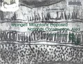 Wrangell Mountains National Conservation Area - a proposal (IA WrangellMountainsNationalConservationAreaaProposal).pdf 1,575 × 1,200, 123 pages; 4.77 MB
-
 Wrangells3.jpg 800 × 600; 249 KB
-
 WrangellZanettiWillowLake.jpg 1,132 × 600; 193 KB
.jpg)
.jpg)
.jpg)
.jpg)
.jpg)
.jpg)
.jpg)
.jpg)
.jpg)
.jpg)
.jpg)


.jpg)
.jpg)


.jpg)

.jpg)

.JPG)

.jpg)


.jpg)


.jpg)
.jpg)


.jpg)


.jpg)
.jpg)


.jpg)
.jpg)
.jpg)
.jpg)
.jpg)


Categories:
- 1980 establishments in the United States
- Chugach Census Area, Alaska
- Copper River Census Area, Alaska
- Kluane / Wrangell – St. Elias / Glacier Bay / Tatshenshini–Alsek
- National parks in Alaska
- National parks of the United States by name
- National Preserves of the United States
- Protected areas established in 1980
- Saint Elias Mountains
- Southeast Fairbanks Census Area, Alaska
- World Heritage Sites in the United States
- Wrangell Mountains
- Yakutat City and Borough, Alaska
- IUCN Category II
- IUCN Protected areas of the United States
- Alaska-St. Elias Range Tundra Ecoregion