Category:Maps of Death Valley National Park
Appearance
United States national parks: Acadia · American Samoa · Arches · Badlands · Big Bend · Biscayne · Black Canyon of the Gunnison · Bryce Canyon · Canyonlands · Capitol Reef · Carlsbad Caverns · Channel Islands · Congaree · Crater Lake · Cuyahoga Valley · Death Valley · Denali · Dry Tortugas · Everglades · Gateway Arch · Gates of the Arctic · Glacier · Glacier Bay · Grand Canyon · Grand Teton · Great Basin · Great Smoky Mountains · Guadalupe Mountains · Haleakalā · Hawaii Volcanoes · Hot Springs · Indiana Dunes · Isle Royale · Joshua Tree · Kenai Fjords · Kings Canyon · Kobuk Valley · Lake Clark · Lassen Volcanic · Mammoth Cave · Mesa Verde · Mount Rainier · North Cascades · Olympic · Petrified Forest · Pinnacles · Redwood · Rocky Mountain · Saguaro · Sequoia · Shenandoah · Theodore Roosevelt · Virgin Islands · Voyageurs · White Sands · Wind Cave · Wrangell-St. Elias · Yellowstone · Yosemite · Zion
Wikimedia category | |||||
| Upload media | |||||
| Instance of | |||||
|---|---|---|---|---|---|
| Category combines topics | |||||
| Death Valley National Park | |||||
US national park in the state of California | |||||
| Instance of | |||||
| Location | California, Pacific States Region | ||||
| Operator | |||||
| Heritage designation |
| ||||
| IUCN protected areas category | |||||
| Inception |
| ||||
| Highest point | |||||
| Area |
| ||||
| Visitors per year |
| ||||
| Maximum temperature record |
| ||||
| official website | |||||
 | |||||
Subcategories
This category has only the following subcategory.
Media in category "Maps of Death Valley National Park"
The following 44 files are in this category, out of 44 total.
-
Map of Death Valley National Park.jpg 4,057 × 5,225; 2.76 MB
-
Badwater tm5 2007046.jpg 720 × 480; 131 KB
-
Below sea map for Death Valley.png 298 × 411; 19 KB
-
California a guide to the Golden state page 647.png 2,125 × 3,054; 914 KB
-
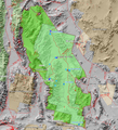
Death Valley DEM with boundary.JPG 775 × 752; 206 KB
-
Death Valley from space numbers.JPG 425 × 580; 77 KB
-
Death Valley from space.JPG 425 × 580; 86 KB
-
Death Valley National Park.svg 1,000 × 1,000; 15 KB
-
Death Valley NP master map.png 853 × 936; 951 KB
-
Death Valley NPS 250,000 map.jpg 2,041 × 3,193; 777 KB
-
Death Valley,20000223,free map.png 1,214 × 1,565; 1 MB
-
Death Valley,20031222,Desert,view from Landsat.jpg 4,362 × 3,876; 755 KB
-
Death-valley-Daymap.jpg 500 × 610; 40 KB
-
DeathValleyfreemap.pdf 2,529 × 3,260; 1.07 MB
-
Deathvalleymap.jpg 334 × 425; 72 KB
-
Headquarters & Park Village - NARA - 84786370.jpg 11,059 × 6,976; 6.12 MB
-
Lake Badwater, Death Valley, 2005.jpg 720 × 480; 139 KB
-
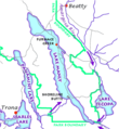
Lake Manly system.gif 1,160 × 1,260; 207 KB
-
Lake Manly system.png 290 × 315; 16 KB
-
Location Death Valley National Park.svg 286 × 186; 171 KB
-
LocMap Death Valley.png 280 × 183; 14 KB
-
Map of Death Valley NP.png 556 × 677; 25 KB
-
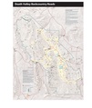
NPS death-valley-backcountry-roads-map.jpg 4,213 × 5,908; 3.09 MB
-
NPS death-valley-backcountry-roads-map.pdf 3,300 × 3,900; 1.03 MB
-
NPS death-valley-desolation-canyon-trail-map.jpg 1,497 × 1,059; 428 KB
-
NPS death-valley-furnace-creek-campground-map.gif 1,275 × 1,650; 200 KB
-
NPS death-valley-furnace-creek-campground-map.pdf 1,275 × 1,650; 147 KB
-
NPS death-valley-furnace-creek-map.jpg 786 × 595; 71 KB
-
NPS death-valley-furnace-creek-map.pdf 470 × 356; 81 KB
-
NPS death-valley-las-vegas-road-map.gif 1,129 × 1,285; 160 KB
-
NPS death-valley-little-bridge-canyon-map.jpg 1,161 × 1,380; 498 KB
-
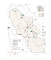
NPS death-valley-map.jpg 4,239 × 5,649; 2.77 MB
-
NPS death-valley-map.pdf 2,541 × 3,387; 8.7 MB
-
NPS death-valley-national-park-map.jpg 3,331 × 4,456; 3.49 MB
-
NPS death-valley-national-park-map.pdf 2,510 × 3,358; 2.71 MB
-
NPS death-valley-new-furnace-creek-map.jpg 1,326 × 974; 191 KB
-
NPS death-valley-new-furnace-creek-map.pdf 764 × 560; 1.65 MB
-
NPS death-valley-printable-map.jpg 3,300 × 3,900; 941 KB
-
NPS death-valley-printable-map.pdf 3,300 × 3,900; 1.26 MB
-
NPS death-valley-regional-map.gif 1,629 × 1,472; 137 KB
-
NPS death-valley-trail-map-golden-canyon-gower-gulch.jpg 1,630 × 1,134; 518 KB
-
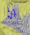
Pleistocene Lakes and Rivers of Mojave.png 545 × 631; 142 KB


