Category:Maps of Yosemite National Park
Appearance
United States national parks: Acadia · American Samoa · Arches · Badlands · Big Bend · Biscayne · Black Canyon of the Gunnison · Bryce Canyon · Canyonlands · Capitol Reef · Carlsbad Caverns · Channel Islands · Congaree · Crater Lake · Cuyahoga Valley · Death Valley · Denali · Dry Tortugas · Everglades · Gateway Arch · Gates of the Arctic · Glacier · Glacier Bay · Grand Canyon · Grand Teton · Great Basin · Great Smoky Mountains · Guadalupe Mountains · Haleakalā · Hawaii Volcanoes · Hot Springs · Indiana Dunes · Isle Royale · Joshua Tree · Kenai Fjords · Kings Canyon · Kobuk Valley · Lake Clark · Lassen Volcanic · Mammoth Cave · Mesa Verde · Mount Rainier · North Cascades · Olympic · Petrified Forest · Pinnacles · Redwood · Rocky Mountain · Saguaro · Sequoia · Shenandoah · Theodore Roosevelt · Virgin Islands · Voyageurs · White Sands · Wind Cave · Wrangell-St. Elias · Yellowstone · Yosemite · Zion
- Maps of Yosemite National Park — in California.
Wikimedia category | |||||
| Upload media | |||||
| Instance of | |||||
|---|---|---|---|---|---|
| Category combines topics | |||||
| Yosemite National Park | |||||
national park in California, United States | |||||
| Instance of | |||||
| Location | |||||
| Visitor center |
| ||||
| Operator | |||||
| Has part(s) |
| ||||
| Heritage designation |
| ||||
| IUCN protected areas category | |||||
| Inception |
| ||||
| Mountain range | |||||
| Highest point | |||||
| Area |
| ||||
| Visitors per year |
| ||||
| official website | |||||
 | |||||
Subcategories
This category has the following 3 subcategories, out of 3 total.
Media in category "Maps of Yosemite National Park"
The following 194 files are in this category, out of 194 total.
-
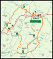
Yosemite National Park Map.png 508 × 600; 23 KB
-
Washburn Point Carte OSM.png 957 × 576; 159 KB
-
Sequoia-area-map.jpg 694 × 548; 105 KB
-
194 of 'United States Pictures. Drawn with pen and pencil, etc' (11210503504).jpg 2,896 × 1,937; 1.33 MB
-
Aerial map of Yosemite National Park showing patents (622d6b79-3142-4322-9821-27d523db606d).tif 4,704 × 4,115; 36.42 MB
-
Aerial topographic map of Yosemite National Park (4802c270-8794-4dcd-9916-c2e5ac96fac1).tif 5,652 × 6,445; 57.25 MB
-
AmCyc Yosemite - map.jpg 3,377 × 2,173; 1.61 MB
-
California a guide to the Golden state page 669.png 1,983 × 3,384; 1.55 MB
-
Elemental Yosemite labeled.jpg 7,844 × 4,541; 4.12 MB
-
Elemental Yosemite no labels.jpg 7,844 × 4,541; 3.93 MB
-
Emerald poolwarningsign.JPG 2,048 × 1,536; 1.46 MB
-
FortMonroe-1897USGSmap.png 1,844 × 938; 3.15 MB
-
HighSierraTrail.png 795 × 889; 336 KB
-
Karte Yosemite-Nationalpark.jpg 1,461 × 1,876; 462 KB
-
Karte Yosemite-Nationalpark.png 3,066 × 3,953; 5.55 MB
-
Land Ownership Map Yosemite National Park (8cac69fb-7788-4cee-b9d0-d9236b9bee27).tif 8,728 × 7,257; 115.71 MB
-
Lands Involved in Exchange Contract of April 1922 (a02dd1a4-8f69-4754-b1d2-61f77848f063).tif 6,628 × 8,026; 86.02 MB
-
LocMap Yosemite.PNG 280 × 183; 15 KB
-
Map No. 1 Showing Park Trail Systems (cab7cf00-f83e-4b81-9922-0cbfa346263e).tif 9,596 × 8,730; 193.5 MB
-
Map No. 2 Trail Map Showing Type of Construction (2b0b37ce-0502-425e-a839-e0d08a5df996).tif 9,488 × 8,734; 189.51 MB
-
Map of gravestones in Yosemite Valley cemetery (3b0bf756-120c-420a-89cb-019f5b983b23).tif 5,732 × 7,841; 80.41 MB
-
Map of Rail and Stage Routes to the Yosemite 1885.jpg 1,691 × 1,125; 876 KB
-
Map of Site Camp Tecoya and Camp Tecoya Annex (5ca1bcbd-3e39-4319-b3ac-e4cedce7c167).tif 5,992 × 3,866; 41.37 MB
-
Map of Site Hetch Hetchy Lodge at Mather Station HHRR (82be0b88-096d-40c9-ac35-a0542a39d3d3).tif 5,940 × 3,866; 40.64 MB
-
Map of Site Housekeeping Camp n Camp 17 Yosemite (a1e9b9cf-4ce6-495d-a343-9c7ed2b8af34).tif 6,008 × 3,892; 40.07 MB
-
Map of the Yosemite National Park (0855d4ea-f968-45cf-9ee5-984e2711be62).tif 6,016 × 4,962; 70.33 MB
-
Map of the Yosemite National Park (107ded71-754d-4e9e-8a86-6e966cb94a5b).tif 7,504 × 5,437; 73.97 MB
-
Map of the Yosemite National Park (78ed59d5-c5bd-48b9-ad30-a11c2c77bafc).tif 5,820 × 4,837; 69.44 MB
-
Map of the Yosemite Valley from Surveys (835b3d78-bd1c-448f-9d8d-bf8f29a0a864).tif 7,344 × 5,994; 91.93 MB
-
Map of the Yosemite Valley from Surveys (b611ef0f-0fa4-4fdc-a52c-4d82b712aebb).tif 7,356 × 5,994; 82.18 MB
-
Map of Vicinity of Arched Rocks El Portal Road (e926c4ee-6ca5-4a3b-922a-d31091f29526).tif 7,844 × 4,044; 53.69 MB
-
Map of Yosemite National Park (a06fefb6-ffd4-4bf8-84dd-4fcdd0cf5c1b).tif 6,216 × 5,046; 72.04 MB
-
Map of Yosemite National Park (f5a1183e-3414-4b83-830b-ceb9618cb6fa).tif 6,180 × 4,919; 67.93 MB
-
Map of Yosemite Valley (0596f00d-3c21-4b07-ac58-4d1106f267c0).tif 11,248 × 5,399; 118.74 MB
-
Map of Yosemite West.png 700 × 646; 216 KB
-
Map-USA-Yosemite.svg 744 × 1,052; 199 KB
-
Map-USA-Yosemite00.png 1,041 × 836; 273 KB
-
Master Plan for Yosemite National Park - Floor of the Valley East.jpg 17,462 × 15,897; 236.76 MB
-
Master Plan for Yosemite National Park - Floor of the Valley West.jpg 17,627 × 15,897; 308.91 MB
-
Master Plan for Yosemite National Park - Glacier Point.jpg 10,952 × 7,748; 77.24 MB
-
Master Plan for Yosemite National Park - Interpretive plan.jpg 10,952 × 7,748; 85.43 MB
-
Master Plan for Yosemite National Park - Mariposa and Wawona.jpg 14,625 × 10,210; 175.83 MB
-
Master Plan for Yosemite National Park - New Indian Village and Arch Rock Entry.jpg 7,290 × 5,092; 63.04 MB
-
Master Plan for Yosemite National Park - Trail System.tif 8,000 × 5,207, 2 pages; 94.76 MB
-
NPS curry-village-historic-map.jpg 2,380 × 1,161; 505 KB
-
NPS pioneer-yosemite-history-center.jpg 1,390 × 1,642; 351 KB
-
NPS yosemite-ahwahnee-historic-map.gif 2,040 × 1,320; 341 KB
-
NPS yosemite-ahwahnee-historic-map2.gif 2,040 × 1,320; 363 KB
-
NPS yosemite-ahwahnee-hotel-map.gif 1,342 × 1,172; 129 KB
-
NPS yosemite-ahwahnee-map.gif 2,040 × 1,320; 857 KB
-
NPS yosemite-ahwahnee-view-map.gif 2,040 × 1,320; 882 KB
-
NPS yosemite-badger-pass-map.gif 1,122 × 866; 63 KB
-
NPS yosemite-badger-pass-ski-map.jpg 3,060 × 1,980; 1.03 MB
-
NPS yosemite-badger-pass-winter-trails-map.gif 1,833 × 1,487; 620 KB
-
NPS yosemite-bridalveil-creek-campground-map.gif 556 × 533; 35 KB
-
NPS yosemite-camp-4-map.gif 1,025 × 1,354; 120 KB
-
NPS yosemite-campground-map.jpg 2,158 × 2,673; 398 KB
-
NPS yosemite-campground-map.pdf 1,293 × 1,604; 2.01 MB
-
NPS yosemite-crane-flat-campground-map.gif 906 × 1,867; 85 KB
-
NPS yosemite-crane-flat-hiking-map.jpg 2,799 × 1,549; 771 KB
-
NPS yosemite-crane-flat-winter-trails-map.gif 1,836 × 1,442; 347 KB
-
NPS yosemite-curry-village-map.gif 1,378 × 1,259; 187 KB
-
NPS yosemite-glacier-point-hiking-map.jpg 2,799 × 1,558; 745 KB
-
NPS yosemite-glacier-point-map.gif 1,094 × 831; 103 KB
-
NPS yosemite-glen-aulin-map.gif 1,356 × 1,052; 89 KB
-
NPS yosemite-happy-isles-map.gif 1,092 × 1,037; 140 KB
-
NPS yosemite-hetch-hetchy-map.gif 1,076 × 710; 59 KB
-
NPS yosemite-hetch-hetchy-map.jpg 1,204 × 806; 125 KB
-
NPS yosemite-hodgdon-meadow-campground-map.gif 556 × 746; 54 KB
-
NPS yosemite-hodgdon-meadow-map.gif 1,097 × 659; 65 KB
-
NPS yosemite-lodge-map.gif 1,372 × 1,097; 131 KB
-
NPS yosemite-lower-pines-campground-map.gif 556 × 326; 27 KB
-
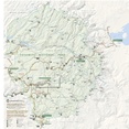
NPS yosemite-map.jpg 3,300 × 3,386; 1.84 MB
-
NPS yosemite-map.pdf 2,475 × 2,539; 10.81 MB
-
NPS yosemite-mariposa-grove-hiking-map.gif 1,356 × 1,430; 96 KB
-
NPS yosemite-mariposa-grove-winter-trails-map.gif 1,824 × 1,436; 233 KB
-
NPS yosemite-may-lake-map.gif 670 × 875; 43 KB
-
NPS yosemite-merced-lake-map.gif 1,420 × 820; 60 KB
-
NPS yosemite-north-pines-campground-map.gif 556 × 376; 21 KB
-
NPS yosemite-picnic-areas-map.gif 1,068 × 1,155; 175 KB
-
NPS yosemite-porcupine-flat-campground-map.gif 1,095 × 556; 74 KB
-
NPS yosemite-recent-rockfall-map.jpg 1,004 × 435; 105 KB
-
NPS yosemite-sunrise-map.gif 1,304 × 1,224; 95 KB
-
NPS yosemite-tamarck-flat-campground-map.gif 556 × 437; 39 KB
-
NPS yosemite-trailhead-map.jpg 3,220 × 4,370; 2.17 MB
-
NPS yosemite-tuolumne-meadows-campground-map.gif 1,802 × 916; 130 KB
-
NPS yosemite-tuolumne-meadows-hiking-map.gif 2,546 × 1,342; 188 KB
-
NPS yosemite-tuolumne-meadows-lodge-map.gif 1,344 × 914; 84 KB
-
NPS yosemite-tuolumne-meadows-map.gif 2,648 × 926; 272 KB
-
NPS yosemite-tuolumne-meadows-map.jpg 2,275 × 1,024; 337 KB
-
NPS yosemite-upper-pines-campground-map.gif 556 × 1,020; 37 KB
-
NPS yosemite-valley-accessibility-map.jpg 1,125 × 864; 140 KB
-
NPS yosemite-valley-hiking-map.jpg 2,799 × 1,567; 736 KB
-
NPS yosemite-valley-map.jpg 4,215 × 1,702; 862 KB
-
NPS yosemite-valley-map.pdf 2,529 × 1,020; 301 KB
-
NPS yosemite-valley-parking-map.jpg 688 × 367; 150 KB
-
NPS yosemite-valley-picnic-areas-map.gif 1,760 × 1,079; 145 KB
-
NPS yosemite-valley-rockfall-map.gif 6,912 × 4,050; 7.28 MB
-
NPS yosemite-valley-shuttle-bus-map.jpg 2,362 × 1,937; 528 KB
-
NPS yosemite-valley-shuttle-bus-map.pdf 3,543 × 2,906; 347 KB
-
NPS yosemite-village-map.gif 1,578 × 1,400; 270 KB
-
NPS yosemite-vogelsang-map.gif 1,292 × 766; 38 KB
-
NPS yosemite-wawona-area-map.gif 3,060 × 1,980; 1.29 MB
-
NPS yosemite-wawona-campground-map.gif 1,804 × 909; 88 KB
-
NPS yosemite-wawona-hiking-map.jpg 2,799 × 1,552; 695 KB
-
NPS yosemite-wawona-historical-map.gif 3,060 × 1,980; 1.19 MB
-
NPS yosemite-wawona-historical-map2.gif 3,060 × 1,980; 1.38 MB
-
NPS yosemite-wawona-historical-map3.gif 3,060 × 1,980; 1.38 MB
-
NPS yosemite-wawona-hotel-map.gif 3,060 × 1,980; 1.06 MB
-
NPS yosemite-wawona-hotel-simple-map.gif 1,376 × 1,680; 133 KB
-
NPS yosemite-wawona-map.gif 1,355 × 1,044; 116 KB
-
NPS yosemite-wawona-map.jpg 1,022 × 942; 166 KB
-
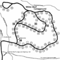
NPS yosemite-white-wolf-campground-map.gif 556 × 550; 41 KB
-
NPS yosemite-white-wolf-map.gif 1,326 × 714; 56 KB
-
NPS yosemite-yosemite-creek-campground-map.gif 556 × 439; 46 KB
-
Patented Lands Within the Yosemite National Park (7c104874-b776-4e41-8026-d1673ec188e0).tif 9,156 × 7,826; 101.98 MB
-
Patented Lands Within the Yosemite National Park (e775f870-8d09-43d2-9383-bf05e9841f38).tif 9,144 × 7,828; 106.48 MB
-
Petition and map from John Muir and other founders of Sierra Club, page 4.tif 2,200 × 1,894; 11.95 MB
-
Petition and map from John Muir and other founders of Sierra Club.djvu 1,497 × 2,500, 4 pages; 4.27 MB
-
Plan and Profile Yosemite Nat'l Park (0ce07e5b-38de-486b-b336-e5df7d746c60).tif 10,984 × 6,594; 127.75 MB
-
Review of reviews and world's work (1890) (14770399471).jpg 1,722 × 1,950; 324 KB
-
California State Route 120.svg 1,152 × 640; 411 KB
-
SW Yosemite map.png 320 × 360; 13 KB
-
Tamarackflatcampground.png 556 × 493; 35 KB
-
The Century Atlas California Northern Part (f0f2d8e5-bc8c-434c-b4df-677b2bbbffb7).tif 5,008 × 3,521; 42.54 MB
-
The Yosemite National Park (1c82f55d-d06b-49fc-9dd5-e53ad83559c9).tif 8,728 × 5,084; 89.4 MB
-
The Yosemite National Park (2f5969da-5bf8-4f9b-82ea-889504f7bc6a).tif 6,396 × 5,089; 73.12 MB
-
The Yosemite National Park (8df7a8f5-3463-4929-8fe3-f28e2af07997).tif 5,996 × 4,978; 63.69 MB
-
The Yosemite National Park (c9d9c795-c09d-4a9d-a5cf-a40c723fb6ac).tif 13,200 × 10,018; 378.34 MB
-
The Yosemite National Park (d79a1c7f-b368-4bcb-8f7d-761fdae149fa).tif 5,944 × 4,999; 67.45 MB
-
The Yosemite National Park (f2b4b775-29b9-44cc-8004-7b3e5a48150e).tif 6,052 × 4,997; 69.49 MB
-
Topographic map of Yosemite National Park, California... - btv1b53064650s.jpg 10,054 × 9,145; 15.88 MB
-
Tuolumne County 1935 Map.jpg 2,370 × 3,003; 1.78 MB
-
Wikiminiatlas new basemap.png 800 × 450; 180 KB
-
Yose veg zonesm.jpg 620 × 749; 88 KB
-
YOSE-Flood-Closure-20230427.jpg 1,600 × 1,104; 300 KB
-
Yosemite - DPLA - 33f38d41701a564fbd3a2f4b51c441ef.jpg 5,514 × 7,000; 7.55 MB
-
Yosemite National Park map enclosed in Sierra Club petition.jpg 1,918 × 1,594; 731 KB
-
Yosemite National Park.svg 1,000 × 1,000; 15 KB
-
Yosemite west map.jpg 700 × 687; 94 KB
-
Yosemite-NP-TF-000.jpg 9,600 × 5,400; 7.59 MB
-
Yosemite-Stage-Routes.jpg 3,751 × 2,119; 9.83 MB


