Category:Maps of Slavonia by Gerardus Mercator
Jump to navigation
Jump to search
Media in category "Maps of Slavonia by Gerardus Mercator"
The following 28 files are in this category, out of 28 total.
-

-
 Slavonia, Croatia, Bosnia, and a part of Dalmatia WDL7484.png 1,306 × 1,024; 2.8 MB
-

-

-
 Atlas Cosmographicae (Mercator) 265.jpg 2,674 × 2,135; 1.8 MB
-
 Dalmatien BV044691015.jpg 8,713 × 6,941; 7.91 MB
-

-

-
 Atlas Minor Gerardi Mercatoris 1609 (106757237).jpg 6,051 × 4,660; 6.02 MB
-
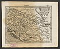
 Sclavonia Croatia Bosnia Dalmatia 1609.jpg 1,276 × 983; 710 KB
-

-

-
 Sclavonia, Croatia, Bosnia, cum Dalmatiae cum Dalmatiae Parte.jpg 4,139 × 3,276; 2.18 MB
-
 Cosmographicae (10534309).jpg 12,061 × 8,088; 27.23 MB
-

-
 Atlas ou Representation du Monde Universel t. 2. 1633 (110102669).jpg 17,251 × 12,015; 33.42 MB
-

-
 Sclavonia Croatia Bosnia Dalmatia 1643-50.jpg 737 × 567; 119 KB
-
 Blaeu 1645 - Sclavonia Croatia Bosnia cum Dalmatiæ parte.jpg 2,973 × 2,295; 1.59 MB
-
 Sclavonia Croatia Bosnia Dalmatia in 1653 atlas by Johannes Janssonius.jpg 3,997 × 3,264; 2.36 MB
-
 "Sclavonia, Croatia, Bosnia cum Dalmatae - Auct. Ger. Mercatore." (22064964728).jpg 4,028 × 3,106; 2.19 MB
-

-
 Sclavonia, Croatia, Bosnia cum Dalmatiae parte - CBT 5883539.jpg 5,187 × 4,083; 6.13 MB
-
 Karta Slavonije, Hrvatske, Bosne i dijela Dalmacije, 17. st.jpg 740 × 619; 173 KB
-
 Sclavonia, Croatia, Bosnia cum Dalmatiae parte - Auct. Ger. Mercatore - btv1b550048829.jpg 7,662 × 5,984; 3.91 MB
-

-
 Dalmatien BV044691165.jpg 8,969 × 6,996; 8.87 MB
-
 Dalmatien BV044704601.jpg 3,656 × 2,956; 2.19 MB


.jpg)
.jpg)
_265.jpg)

.jpg)
.jpg)
.jpg)

_-_btv1b53096740c_(471_of_603).jpg)
.jpg)

.jpg)
.jpg)
.jpg)
.jpg)


.jpg)
.2.(33).jpg)


.jpg)


Categories:
- Maps of Eastern Europe and the Balkans by Gerardus Mercator
- Old maps of Slavonia
- Old maps of Dalmatia
- Old maps of Vojvodina
- 16th-century maps of Croatia
- 16th-century maps of Bosnia and Herzegovina
- 16th-century maps of Serbia
- Rascia (Pannonian Plain)
- Old maps of the Danube
- 1600s maps of the Balkans
- 16th-century maps of the Ottoman Empire
- 16th-century maps of the Habsburg Monarchy