Category:Old maps of Vojvodina
Jump to navigation
Jump to search
Use the appropriate category for maps showing all or a large part of Vojvodina. See subcategories for smaller areas:
| If the map shows | Category to use |
|---|---|
| Vojvodina on a recently created map | Category:Maps of Vojvodina or its subcategories |
| Vojvodina on a map created more than 70 years ago | Category:Old maps of Vojvodina or its subcategories |
| the history of Vojvodina on a recently created map | Category:Maps of the history of Vojvodina or its subcategories |
| the history of Vojvodina on a map created more than 70 years ago | Category:Old maps of the history of Vojvodina or its subcategories |
Subcategories
This category has the following 3 subcategories, out of 3 total.
Media in category "Old maps of Vojvodina"
The following 65 files are in this category, out of 65 total.
-
 1600 map - Sclavonia, Bosnia, Croatia und Dalmatia.tif 3,181 × 2,173; 27.01 MB
-
 Rascia01.jpg 655 × 640; 159 KB
-
 Banat1700.jpg 737 × 623; 157 KB
-

-

-

-
 Péterváradi csata-1716.jpg 800 × 617; 250 KB
-
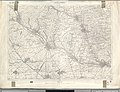
 Plan - von Peterwardein - btv1b8493808j.jpg 8,356 × 6,703; 6.28 MB
-
-
 Novi sad map 1805.jpg 1,608 × 2,682; 2.13 MB
-
 Novi sad map 1845.jpg 2,106 × 2,670; 3.08 MB
-
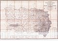
 Voivodeship of serbia ethnic map 1855.jpg 1,751 × 1,211; 1.15 MB
-
 Bela Crkva BV042105039.jpg 9,712 × 7,395; 12.81 MB
-
 Kikinda BV043905316.jpg 14,404 × 11,102; 22.78 MB
-
 Novi Kneževac BV043903523.jpg 14,406 × 11,102; 22.93 MB
-
 Subotica BV043903478.jpg 14,406 × 11,102; 26.3 MB
-
 Vrbas BV043905939.jpg 14,406 × 11,102; 23.65 MB
-
 Belgrád - 38-45 (cropped).jpg 1,079 × 809; 249 KB
-
 Belgrád - 38-45.jpg 3,591 × 4,952; 4.36 MB
-
 Hrvatski skolski muzej Zupanija Sriemska 300109.jpg 1,200 × 766; 752 KB
-
 Hrvatski skolski muzej Zupanija Sriemska-Bobota.jpg 801 × 511; 93 KB
-
 Hrvatski skolski muzej Zupanija Sriemska-Borovo.jpg 801 × 511; 93 KB
-
 Hrvatski skolski muzej Zupanija Sriemska-Negoslavci.jpg 800 × 511; 93 KB
-
 Hrvatski skolski muzej Zupanija Sriemska-Trpinja.jpg 801 × 512; 94 KB
-
 Bačka Palanka BV042104313.jpg 9,641 × 7,395; 11.41 MB
-
 Gudurica BV042104703.jpg 9,720 × 7,395; 13.16 MB
-
 Vršac BV042104694.jpg 8,904 × 7,397; 10.44 MB
-
 Zrenjanin BV042104364.jpg 8,759 × 7,396; 9.4 MB
-
 Novi Sad BV042104340.jpg 9,665 × 7,395; 9.89 MB
-
 Šid BV042104673.jpg 9,628 × 7,395; 14.1 MB
-
 Senta (Wojwodina) BV043905347.jpg 14,406 × 11,102; 25.35 MB
-
 Sombor BV043905446.jpg 14,406 × 11,102; 26.28 MB
-
 Bijeljina BV042104727.jpg 9,435 × 7,395; 13.74 MB
-
 Kovačica BV042104685.jpg 9,256 × 7,395; 9.57 MB
-
 Novi Bečej BV042103175.jpg 9,519 × 7,395; 9.24 MB
-
 Pančevo BV042105226.jpg 8,448 × 7,395; 10.65 MB
-
 Sremska Mitrovica BV042104733.jpg 9,379 × 7,396; 11.16 MB
-
 Sremski Karlovci BV042104683.jpg 9,441 × 7,395; 11.05 MB
-
 Stara Pazova BV042104994.jpg 9,413 × 7,395; 9.84 MB
-
 Žitište BV042103231.jpg 9,452 × 7,395; 9.05 MB
-
 Bezirk Srem BV042105196.jpg 9,331 × 7,395; 10.22 MB
-
 Banat-Lorrains.jpg 1,626 × 613; 204 KB
-
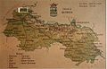
 Bacs-Bodrog county map.jpg 1,697 × 2,125; 889 KB
-
 Banat Josephinische Landaufnahme pg000.jpg 7,181 × 8,764; 34.15 MB
-
 Bistrica novi sad 16th century.JPG 1,509 × 1,094; 371 KB
-
 Harta Iozefina a Banatului background 1769-72.jpg 800 × 976; 268 KB
-
 Militargrenze, Wojwodowena und Banat.jpg 900 × 312; 115 KB
-
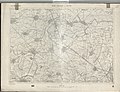
 Mistrowitz - 37-45.jpg 3,582 × 4,941; 4.48 MB
-
 Novi sad map 1745.jpg 3,112 × 2,054; 2.33 MB
-
 Petrovaradin 1688.jpg 239 × 302; 14 KB
-
 Petrovaradin 1692.jpg 382 × 295; 19 KB
-
 Petrovaradin 1693.jpg 300 × 212; 13 KB
-
 Rascia Banat02.jpg 912 × 1,498; 1.62 MB
-
 Rasciani Banat.JPG 301 × 297; 47 KB
-
 Ratzen stadt 18thcentury.jpg 1,521 × 1,146; 896 KB
-
 Ratzen Stadt01.jpg 582 × 804; 780 KB
-
 Ratzenstatt and almas 1716 17.jpg 1,486 × 938; 680 KB
-
 Siege of Petrovaradin 1694.jpg 300 × 226; 20 KB
-
 Szabadka - 37-46.jpg 3,528 × 4,952; 4.31 MB
-
 Szeged - 38-46.jpg 3,519 × 4,951; 4.41 MB
-
 Szerem County Map.jpg 2,100 × 1,657; 383 KB
-
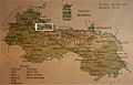
 Temes county map.jpg 1,650 × 2,115; 499 KB
-
 Torontal county map.jpg 1,650 × 2,138; 513 KB
-
 Versecz - 39-45.jpg 3,582 × 4,939; 4.45 MB
-
 Vojvodschaft serbien 1853.jpg 800 × 563; 169 KB


.jpg)


.jpg)


_BV043905347.jpg)


