Category:Old maps of Slavonia
Jump to navigation
Jump to search
Subcategories
This category has the following 3 subcategories, out of 3 total.
M
S
- Schiavonia (2 F)
Media in category "Old maps of Slavonia"
The following 21 files are in this category, out of 21 total.
-
 Girolamo Ruscelli - Tavola Nuova Di Schiavonia (1561).jpg 1,298 × 1,000; 1.45 MB
-
 Hirschvogel - Sclavonia oder Windisch Marck, Bossen, Crabaten, etc.jpg 4,329 × 3,723; 4.95 MB
-
 1600 map - Sclavonia, Bosnia, Croatia und Dalmatia.tif 3,181 × 2,173; 27.01 MB
-
 Sirmien BV044705964 1.jpg 10,410 × 13,232; 17.63 MB
-
 Sirmien BV044705964 2.jpg 10,509 × 13,172; 14.49 MB
-
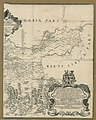
 Regnum Bosniae, una cum finitimis Croatiae, Damatiae, Slavoniae, Hung et Servia partibus.jpg 3,070 × 1,400; 5.31 MB
-
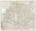
 Map of Central Europe in 1791 by Reilly 003.jpg 1,196 × 817; 442 KB
-
-
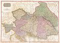 1818 Pinkerton Map of the Austrian Empire - Geographicus - Austria-pinkerton-1818.jpg 5,000 × 3,642; 5.51 MB
-

-
 Dalmatia 1852.JPG 456 × 313; 189 KB
-
 EB9 Hungary ACB.png 737 × 521; 885 KB
-
 EB9 Hungary CSS.png 3,740 × 2,625; 13.71 MB
-
 EB9 Hungary RSP.png 3,590 × 2,515; 14.08 MB
-
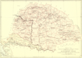
 Kuti 1781 - 1783.jpg 759 × 625; 146 KB
-
 Map of Slavonia (ex-Yugoslavia) (1600) north east.jpg 800 × 600; 168 KB
-
 Map of Slavonia (ex-Yugoslavia) (1600) north west.jpg 800 × 600; 166 KB
-
 Map of Slavonia (ex-Yugoslavia) (1600) south east.jpg 800 × 600; 161 KB
-
 Map of Slavonia (ex-Yugoslavia) (1600) south west.jpg 800 × 600; 157 KB
-
 Map of Slavonia (ex-Yugoslavia) (1600).jpg 800 × 600; 131 KB
-
 Map of Slavonia, Croatia, Carnia, Istria, and Bosnia by Abraham Ortelius.jpeg 1,597 × 1,188; 540 KB
.jpg)


_(1600)_north_east.jpg)
_(1600)_north_west.jpg)
_(1600)_south_east.jpg)
_(1600)_south_west.jpg)
_(1600).jpg)
