Category:Old maps of the Danube
Jump to navigation
Jump to search
Subcategories
This category has the following 3 subcategories, out of 3 total.
M
O
Media in category "Old maps of the Danube"
The following 108 files are in this category, out of 108 total.
-

-

-

-

-
 1540 Sebastian Münster map locating Kyiv.jpg 1,600 × 1,265; 1.13 MB
-
 Cosmographia (Sebastian Münster) p 102.jpg 2,000 × 1,455; 507 KB
-
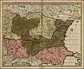
 Poloniae et Ungariae zMünstera.jpg 2,328 × 1,840; 1.49 MB
-

-
 1593 map of the Danube by Cornelis de Jode.jpg 2,326 × 1,600; 1.2 MB
-
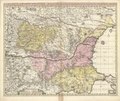
 Blaeu 1645 - Austria Archiducatus.jpg 3,633 × 3,038; 1.6 MB
-
 Totius Regni Hungariae, et adjacentium Regionum Tabulа (Visscher, 1657).jpg 4,000 × 2,149; 1.8 MB
-
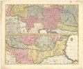
 Bodleian Libraries, Hungaria Regnum.jpg 1,000 × 781; 127 KB
-
 1665 map - Cours du Danube.jpg 11,808 × 8,008; 16.05 MB
-
 1677 map of the Balkans by Nicolaes Visscher II.jpg 7,239 × 5,950; 11.53 MB
-
 1683-Türkenkrieg um Wien.JPG 1,761 × 1,729; 3 MB
-
 Map of the Balkan Peninsula 1686.jpg 9,673 × 5,492; 22.46 MB
-
 Marche, campement, leger ordre nevens de gloriese victoire, etc (BM 1859,0514.330.191).jpg 2,500 × 1,844; 1.21 MB
-

-
 Corso Del Danubio da Vienna Sina a Nicopoli, e Paesi Adiacenti.jpg 33,340 × 29,525; 175.82 MB
-
 Atlante Veneto Volume 1 143.jpg 6,603 × 9,808; 8.3 MB
-
 Fluminum princeps Danubius - CBT 5873405.jpg 5,715 × 4,750; 8.23 MB
-

-

-

-

-

-

-
 1731 map of the middle part of the Danube by Johann Baptist Homann.jpg 16,547 × 13,854; 43.09 MB
-

-
 Ca. 1740 map of Vidin and the Baba Vida Fortress.jpg 11,709 × 14,779; 30.11 MB
-
 1760s map of the Danube River.djvu 20,471 × 5,939; 8.16 MB
-
 1768 map - Carte Geographique de la nouvelle Communication entre le Danube &. la Moldau.jpg 5,232 × 7,542; 4.49 MB
-
 Pannonia moesia dacia illyricum.jpg 1,600 × 1,085; 559 KB
-

-
 1800 Pressburgh detail of map of Turkey by Mathew Carey BPL 12328.png 1,064 × 747; 1.37 MB
-

-
-

-
 1843 map of the Danube.jpg 17,664 × 12,401; 38.16 MB
-

-

-

-
 Le Tour du monde-11-p071.jpg 2,874 × 1,968; 1.77 MB
-
 Donau BV043563753.jpg 3,831 × 9,548; 3.07 MB
-

-

-

-

-
 137 of 'The “Beaumont” Geography and Map Tracing Book' (11245743773).jpg 2,384 × 1,450; 729 KB
-

-
 États danubiens (1898).JPG 5,226 × 3,852; 7.08 MB
-
 341 of 'The International Geography. ... Edited by H. R. Mill' (11289067765).jpg 1,400 × 735; 275 KB
-
-

-

-
-
 241 of 'Camping Voyages on German Rivers, etc' (11203439013).jpg 1,204 × 2,028; 256 KB
-

-
 3 - Walachei, Donaumündung, westl Siebenbürgen; Scheda-Karte europ Türkei.jpg 6,399 × 4,512; 34.13 MB
-

-

-

-

-

-

-

-
 A New Depiction of the Whole of Hungary WDL6761.png 1,657 × 1,024; 3.59 MB
-
 Austria Lazius 1662 Atlas Blaeuw.jpg 11,220 × 7,918; 85.1 MB
-
 Balkanhalbinsel BV014334758.jpg 10,528 × 8,666; 11.65 MB
-

-

-

-
 Charte von Schwaben Tafel 29 Donauquellen.jpg 2,123 × 2,615; 4.45 MB
-
 Danubis 1636 Janssonius-Blaeu.jpg 3,264 × 1,424; 3.47 MB
-
 Danubis 1636 Janssonius-Blaeu1.jpg 3,302 × 1,446; 2.54 MB
-

-
 Donaustrudel 1721.jpg 650 × 450; 135 KB
-
 Eastern-hungarian-kingdom1550-es.svg 3,561 × 2,489; 1.54 MB
-
 Eastern-hungarian-kingdom1550-hu.svg 3,561 × 2,489; 993 KB
-
 Exactissima Tabula qua tam Danubii Fluvii Pars Inferior.jpg 4,934 × 4,068; 3.89 MB
-
 Hausstein 1721.jpg 650 × 450; 132 KB
-
 Karte Donau von Quelle bis Mündung.jpg 1,200 × 553; 688 KB
-

-

-
 Lazius - Austriae descrip.jpg 2,263 × 1,700; 2.55 MB
-
 Map - Special Collections University of Amsterdam - OTM- HB-KZL 32.03.20.tif 7,296 × 6,155; 128.48 MB
-
 Map - Special Collections University of Amsterdam - OTM- HB-KZL 32.03.25.tif 7,377 × 6,214; 131.15 MB
-
 Map - Special Collections University of Amsterdam - OTM- HB-KZL 32.03.26.tif 7,457 × 6,130; 130.78 MB
-
 Map - Special Collections University of Amsterdam - OTM- HB-KZL 32.03.28.tif 7,285 × 5,998; 125.01 MB
-
 Map - Special Collections University of Amsterdam - OTM- HB-KZL 32.03.29.tif 7,583 × 6,305; 136.79 MB
-
 Map - Special Collections University of Amsterdam - OTM- HB-KZL 32.03.37.tif 7,900 × 6,626; 149.76 MB
-
 Map - Special Collections University of Amsterdam - OTM- HB-KZL 32.03.42.tif 7,548 × 6,384; 137.86 MB
-
 Matthäus Seutter Danube c1730.png 5,040 × 1,466; 16.02 MB
-
 Nicolaes Visscher I - Danvbiuvs, fluvius Europae maximus.jpg 640 × 281; 69 KB
-
 Physical map of the Kingdom of Hungary before 1919-es.svg 3,561 × 2,489; 25.79 MB
-
 Physical map of the Kingdom of Hungary before 1919.jpg 2,423 × 1,839; 5.73 MB
-
 PLAN EIN STICK VON DER DANAW.jpg 2,880 × 1,043; 440 KB
-

-

-
 RepartoHungríaTratadoDeTrianon1920.svg 3,561 × 2,489; 25.83 MB
-

-
 UBBasel Map 1566 Kartenslg AA 92 Transilvania.tiff 12,013 × 9,735, 2 pages; 334.61 MB
-
 Wirbel-Hausstein 1791.jpg 1,280 × 1,008; 1,010 KB
-
 Wirbel-Hausstein 1791.pdf 2,083 × 1,800; 167 KB
-
 Wolfgang Lazius's great map of the Kingdom of Hungary (1552).jpg 1,200 × 846; 314 KB
-
 Wolfgang Lazius, Hungariae Descriptio (FL35076533 2541227).jpg 12,754 × 9,534; 174.92 MB
-
 Wörth (Donauinsel) Joseph Walcher 1791 map.jpg 1,927 × 1,348; 737 KB
-
 Wörth (Donauinsel) map 1777 map.jpg 8,512 × 6,409; 13.88 MB
.jpg)
%27_(11263907435).jpg)
.jpg)
.jpg)

_p_102.jpg)


.jpg)


.jpg)


.jpg)


_-_Geographicus_-_ImperiiOrientalis-delisle-1715.jpg)
_Constantinopolim_defluentis_exhibiti)_pars_infima.jpg)

.jpg)


_-_btv1b53075277w.jpg)


.jpg)


_With_numerous_maps_and_notes%27_(11108499893).jpg)
_With_numerous_maps_and_notes%27_(11109697273).jpg)
.jpg)
._Traduit_de_l%27allemand,_avec_l%27autorisation_de_l%27auteur_et_annot%C3%A9e_sous_la_direction_de_Emm._de_Margerie._Avec_une_pr%C3%A9f._par_Marcel_Bertrand_(1897)_(14591563117).jpg)
.jpg)
,_etc%27_(11154591493).jpg)
.JPG)
.jpg)
.jpg)
.jpg)
.jpg)
.jpg)
.jpg)
.jpg)

_With_numerous_maps_and_notes%27_(11109114023).jpg)
_With_numerous_maps_and_notes%27_(11109083974).jpg)
_With_numerous_maps_and_notes%27_(11111342845).jpg)
.jpg)
.jpg)
.jpg)
.jpg)


.jpg)


.jpg)


._Traduit_de_l%27allemand,_avec_l%27autorisation_de_l%27auteur_et_annot%C3%A9e_sous_la_direction_de_Emm._de_Margerie._Avec_une_pr%C3%A9f._par_Marcel_Bertrand_(1897)_(14774920561).jpg)
._Traduit_de_l%27allemand,_avec_l%27autorisation_de_l%27auteur_et_annot%C3%A9e_sous_la_direction_de_Emm._de_Margerie._Avec_une_pr%C3%A9f._par_Marcel_Bertrand_(1897)_(14775872444).jpg)


.jpg)


.jpg)
.jpg)
_Joseph_Walcher_1791_map.jpg)
_map_1777_map.jpg)
.jpg)