Category:1600s maps of the Balkans
Jump to navigation
Jump to search
English: This category is intended to collect maps from the 1600s that show multiple Balkan countries in one map frame.
Subcategories
This category has the following 6 subcategories, out of 6 total.
1
B
C
- 1600s maps of Croatia (4 F)
G
- 1600s maps of Greece (8 F)
R
- 1600s maps of Romania (3 F)
S
- 1600s maps of Serbia (1 F)
Media in category "1600s maps of the Balkans"
The following 14 files are in this category, out of 14 total.
-
 Map of Greece(1600) north west.jpg 800 × 600; 162 KB
-
 Map of Greece(1600).jpg 800 × 600; 131 KB
-
 Map of Hungary and its region (1600) south east.jpg 800 × 600; 167 KB
-
 Map of Hungary and its region (1600) south west.jpg 800 × 600; 172 KB
-
 Map of Transylvania, Romania (small) (1600) a closer view.jpg 800 × 600; 169 KB
-
 Румыния б.Фракия со странами Болгария Валахия Сирфия 1602 Антверпен авторы Giacomo.jpg 2,758 × 2,085; 8.65 MB
-

-
 Map of Eastern Mediterranean. HM 34. PORTOLAN ATLAS, anonymous. France (?), ca. 1600.jpg 5,358 × 4,434; 7.34 MB
-
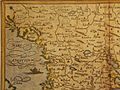
 Map of Slavonia (ex-Yugoslavia) (1600) north east.jpg 800 × 600; 168 KB
-
 Map of Slavonia (ex-Yugoslavia) (1600) north west.jpg 800 × 600; 166 KB
-
 Map of Slavonia (ex-Yugoslavia) (1600) south east.jpg 800 × 600; 161 KB
-
 Map of Slavonia (ex-Yugoslavia) (1600) south west.jpg 800 × 600; 157 KB
-
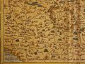
 Map of Slavonia (ex-Yugoslavia) (1600).jpg 800 × 600; 131 KB
-

_north_west.jpg)
.jpg)
_south_east.jpg)
_south_west.jpg)


,_ca._1600.jpg)
_(1600)_north_east.jpg)
_(1600)_north_west.jpg)
_(1600)_south_east.jpg)
_(1600)_south_west.jpg)
_(1600).jpg)

_(1600)_a_closer_view.jpg)