Category:Transport maps of Pakistan
Jump to navigation
Jump to search
Subcategories
This category has the following 2 subcategories, out of 2 total.
P
R
Media in category "Transport maps of Pakistan"
The following 24 files are in this category, out of 24 total.
-
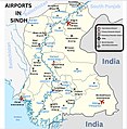 Airports in Sindh.jpg 983 × 1,004; 412 KB
-
 BBYarikMotorway.png 3,256 × 3,125; 317 KB
-
 Brahma Bahtar to Yarik Motorway (1).png 699 × 658; 83 KB
-
 Brahma Bahtar to Yarik Motorway.png 699 × 658; 68 KB
-
 CPEC Western Alignment.png 3,256 × 3,125; 317 KB
-
 CPECWesternAlignment.png 2,030 × 1,640; 357 KB
-
 CPECWesternAlignment1.png 2,030 × 1,640; 357 KB
-
 Karachi Transport Network.png 2,828 × 2,128; 1.44 MB
-
 NATO supply routes through Pakistan.svg 2,365 × 1,890; 727 KB
-
 Pakistan Airports & Seaports.png 2,281 × 2,167; 404 KB
-
 Pakistan M2.svg 1,101 × 1,040; 31 KB
-
 Pakistan motorway (multi-lanes) map.jpg 362 × 315; 19 KB
-
 Pakistan N5.svg 1,126 × 1,052; 35 KB
-
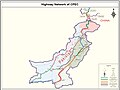
 Pakistan Nationalhighways.PNG 3,256 × 3,125; 1.09 MB
-
 Pakistan roadway map.jpg 3,000 × 1,687; 1.14 MB
-
 Pakistan Transportation.jpg 2,008 × 2,657; 1.42 MB
-
 Phase1KPM.png 1,889 × 1,486; 212 KB
-
 Phase2KPM.png 1,616 × 1,228; 164 KB
-
 Road network CPEC.jpg 962 × 722; 137 KB
-
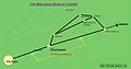 RoadMap Tulamba 01.jpg 891 × 471; 35 KB
-
 Safoora, Karachi.PNG 885 × 422; 46 KB
-
 Swabi.jpg 3,982 × 3,368; 1.77 MB
-
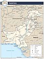
 Un-pakistan.png 3,063 × 4,003; 3.05 MB
-
 喀拉蚩運輸網路.png 2,828 × 2,128; 1.51 MB


.png)


_map.jpg)


