Category:Maps of Afghanistan
Appearance
Maps of Afghanistan.
Wikimedia category | |||||
| Upload media | |||||
| Instance of | |||||
|---|---|---|---|---|---|
| Category combines topics | |||||
 | |||||
Subcategories
This category has the following 30 subcategories, out of 30 total.
- Maps of Afghanistan by decade (empty)
*
B
C
D
E
F
G
H
- Maps of the Hindu Kush (22 F)
K
- Maps of Koh-e Baba (4 F)
L
M
P
S
T
W
Pages in category "Maps of Afghanistan"
The following 2 pages are in this category, out of 2 total.
Media in category "Maps of Afghanistan"
The following 84 files are in this category, out of 84 total.
-
129 of '(British Battles on Land and Sea.)' (11167825313).jpg 1,943 × 2,588; 1,015 KB
-
19th century taymanis map.png 3,000 × 1,342; 2.42 MB
-
20160902 Afghans from Pakistan v3.pdf 1,754 × 1,239; 3.72 MB
-
20160902 Afghans from Pakistan v3.png 1,123 × 794; 1.13 MB
-
20170206 PakistanAfghanistan SnowAvalanches.pdf 1,625 × 1,125; 899 KB
-
9 BIS - NJ-41-16 Sheberghan.jpg 8,704 × 6,609; 5.49 MB
-
A Short Walk in the Hindu Kush Map.svg 847 × 750; 85 KB
-
Afganistan Birleşmiş Milletler haritası.svg 2,000 × 2,000; 691 KB
-
Afghanistan - DPLA - 8ea114902f3ea0f8359fca5429305889.jpg 5,136 × 3,717; 1.41 MB
-
Afghanistan 1 May 2021.jpg 581 × 581; 70 KB
-
Afghanistan 15 July 2021.jpg 581 × 581; 74 KB
-
Afghanistan 2020 COVID-19 Map (Allio-19).png 781 × 600; 98 KB
-
Afghanistan and Pakistan map (UN).png 1,511 × 1,463; 458 KB
-
Afghanistan and the geographical area of Hazaristan in 1890.jpg 504 × 357; 27 KB
-
Afghanistan Domestic Cricket Teams Regions.svg 393 × 300; 361 KB
-
Afghanistan GHI Solar-resource-map GlobalSolarAtlas World-Bank-Esmap-Solargis.png 1,842 × 1,942; 2.27 MB
-
Afghanistan Road Map Overlay.svg 2,800 × 2,062; 152 KB
-
Afghanistan Warlord.png 732 × 461; 31 KB
-
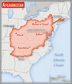
Afghanistan – U.S. area comparison.jpg 701 × 821; 468 KB
-
Afghanistan's Ring Road.png 400 × 280; 26 KB
-
Afghanistan-Pakistan Border - DPLA - 9e39ecc11a1d6af934e4080d0957d7d6.jpg 2,536 × 3,266; 6.6 MB
-
AfghanTurk.PNG 600 × 461; 48 KB
-
Afg‘oniston viloyatlari raqamlar bilan berilgan.png 250 × 192; 9 KB
-
Alexander's Indian route.jpg 1,169 × 1,074; 168 KB
-
Autonomous regions in the Middle East and Asia.jpg 720 × 694; 204 KB
-
Borders of historical territories in current Afghanistan.png 1,000 × 768; 85 KB
-
Commonwealth of Independent States.png 120 × 120; 17 KB
-
ECDM 20140623 Pakistan HumanitarianCrisis.pdf 1,625 × 1,125; 477 KB
-
ECDM 20140801 Pakistan NWA displacement.pdf 1,625 × 1,125; 545 KB
-
ECDM 20150223 World Events.pdf 1,625 × 1,125; 569 KB
-
ECDM 20150227 World Events.pdf 1,625 × 1,125; 712 KB
-
ECDM 20150303 IndiaPakAfghan SevereWeather.pdf 1,625 × 1,125; 397 KB
-
ECDM 20150622 World Refugees IDPs ver3.pdf 3,483 × 2,479; 1.29 MB
-
ECDM 20150729 Asia SevereWeather.pdf 1,625 × 1,125; 551 KB
-
ECDM 20151001 World Events.pdf 1,625 × 1,125; 464 KB
-
ECDM 20160224 CountriesOfOrigin DailyMap.pdf 1,754 × 1,239; 910 KB
-
ECDM 20160415 EQ Event.pdf 1,625 × 1,125; 771 KB
-
ECDM 20160721 World SevereWeather.pdf 1,625 × 1,125; 554 KB
-
ECDM 20190304 Afghanistan-Pakistan Floods.pdf 1,625 × 1,125; 950 KB
-
ECDM 20190306 Afghanistan-Pakistan-Iran Floods.pdf 1,625 × 1,125; 869 KB
-
ECDM 20200113 Iran-Afghanistan-Pakistan.pdf 1,625 × 1,125; 864 KB
-
ECDM 20200430 Iran-Afghanistan.pdf 1,625 × 1,125; 873 KB
-
ECDM 20200908 AfghanistanPakistan Floods.pdf 1,625 × 1,125; 1.14 MB
-
ECHO Afghanistan Editable A4 Landscape.pdf 1,754 × 1,239, 2 pages; 592 KB
-
ECHO Afghanistan Editable A4 Landscape.png 1,123 × 794; 401 KB
-
Ethnolinguistic groups in Afghanistan.jpg 2,048 × 1,874; 334 KB
-
FLII Afghanistan.png 1,304 × 907; 113 KB
-
Hazara Division Map and Jagirdars.jpg 1,080 × 1,710; 841 KB
-
ISAF.png 1,224 × 989; 118 KB
-
Kabul Afghanistan.png 514 × 418; 19 KB
-
Kabul, Jalalabad, Torkham, Peshawar -3.png 514 × 608; 18 KB
-
Kabul, Jalalabad, Torkham, Peshawar -4.png 514 × 721; 15 KB
-
Kabul, Jalalabad, Torkham, Peshawar -7.png 514 × 482; 15 KB
-
Major Powers and Central Asian Invasions, c. 250 BCE - 550 CE.jpg 1,016 × 1,380; 190 KB
-
Map of Afghanistan Ps.svg 1,499 × 1,198; 212 KB
-
Map of Jellalabad 1842.jpg 798 × 642; 149 KB
-
Map of Taliban Afghanistan.png 208 × 166; 10 KB
-
Map to Illustrate the Military Geography of Afghanistan Part IV Kabul Province.png 4,163 × 2,600; 7.43 MB
-
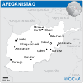
Mapa do Afeganistão (OCHA).svg 254 × 254; 736 KB
-
N 30, E 60 - N 40.1, E 75.1 slope map.png 10,137 × 8,357; 52.35 MB
-
Operational Navigation Chart G-6, 7th edition.jpg 9,254 × 6,700; 20.67 MB
-
Operational Navigation Chart G-7, 6th edition.jpg 9,254 × 6,707; 20.89 MB
-
Pakistan and Afghanistan Map.jpg 486 × 554; 114 KB
-
PAT - Afghanistan.gif 920 × 920; 371 KB
-
Population density of Afghanistan provinces.png 5,435 × 4,323; 867 KB
-
Qarabagh map.jpg 897 × 629; 307 KB
-
Resolute Support Map.jpg 1,196 × 847; 138 KB
-
Sangin and Sorubi, Afghanistan.png 514 × 390; 17 KB
-
South Asia UN.png 2,960 × 3,588; 1.63 MB
-
Sub Regional Economic Cooperation Zones.gif 1,320 × 1,400; 92 KB
-
TAPI-EIA.png 342 × 218; 18 KB
-
Territories of the Islamic State in Afghanistan 1.jpg 794 × 583; 98 KB
-
Territories of the Islamic State in Afghanistan 2.jpg 794 × 583; 98 KB
-
Un-afghanistan.png 3,038 × 2,258; 2.24 MB
-
UNAMA 2012 map.png 3,034 × 2,330; 2.01 MB
-
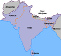
Zemljevid Indijska podcelina.png 400 × 367; 8 KB
-
Филателистическая карта Афганистана.png 600 × 470; 57 KB
-
قلمرو درانیان.png 1,200 × 952; 155 KB
-
高北人主要分布在阿富汗.jpg 377 × 197; 27 KB


