Category:Pakistan maps by U.S. Army Map Service
Jump to navigation
Jump to search
Media in category "Pakistan maps by U.S. Army Map Service"
The following 77 files are in this category, out of 77 total.
-
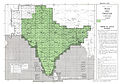 India and Pakistan AMS index.jpg 1,964 × 1,378; 3.78 MB
-

-
 Map India and Pakistan 1-250,000 Tile NG 42-1 Wandhari.jpg 5,000 × 3,932; 4.5 MB
-
 Map India and Pakistan 1-250,000 Tile NG 42-10 Hyderabad.jpg 5,000 × 3,924; 3.85 MB
-
 Map India and Pakistan 1-250,000 Tile NG 42-11 Mirpur Khas.jpg 5,000 × 3,919; 4 MB
-
 Map India and Pakistan 1-250,000 Tile NG 42-12 Barmer.jpg 5,000 × 3,937; 3.68 MB
-
 Map India and Pakistan 1-250,000 Tile NG 42-13 Karachi and Vicinity (verso).jpg 5,000 × 3,736; 1.2 MB
-
 Map India and Pakistan 1-250,000 Tile NG 42-13 Karachi.jpg 5,000 × 3,922; 3.32 MB
-
 Map India and Pakistan 1-250,000 Tile NG 42-14 Tatta.jpg 5,000 × 3,920; 3.13 MB
-
 Map India and Pakistan 1-250,000 Tile NG 42-15 Islamkot.jpg 5,000 × 3,908; 2.86 MB
-
 Map India and Pakistan 1-250,000 Tile NG 42-16 Nagar Parkar.jpg 5,000 × 3,921; 3.72 MB
-
 Map India and Pakistan 1-250,000 Tile NG 42-2 Sukkur.jpg 5,000 × 3,924; 3.03 MB
-
 Map India and Pakistan 1-250,000 Tile NG 42-3 Mirpur Mathelo.jpg 5,000 × 3,929; 3.73 MB
-
 Map India and Pakistan 1-250,000 Tile NG 42-4 Kishangarh.jpg 5,000 × 3,766; 2.85 MB
-
 Map India and Pakistan 1-250,000 Tile NG 42-5 Bela.jpg 5,000 × 3,897; 4.49 MB
-
 Map India and Pakistan 1-250,000 Tile NG 42-6 Nawabshah.jpg 5,000 × 3,913; 3.01 MB
-
 Map India and Pakistan 1-250,000 Tile NG 42-7 Miajlar.jpg 5,000 × 3,804; 2.54 MB
-
 Map India and Pakistan 1-250,000 Tile NG 42-9 Uthal.jpg 5,000 × 3,787; 5.12 MB
-
 Map India and Pakistan 1-250,000 Tile NH 42-1 Spin Baldak.jpg 5,000 × 3,811; 4.45 MB
-
 Map India and Pakistan 1-250,000 Tile NH 42-10 Sibi.jpg 5,000 × 3,817; 5.71 MB
-
 Map India and Pakistan 1-250,000 Tile NH 42-11 Rajanpur.jpg 5,000 × 3,922; 4.57 MB
-
 Map India and Pakistan 1-250,000 Tile NH 42-12 Bahawalpur.jpg 5,000 × 3,921; 4.19 MB
-
 Map India and Pakistan 1-250,000 Tile NH 42-13 Gandava.jpg 5,000 × 3,784; 5.16 MB
-
 Map India and Pakistan 1-250,000 Tile NH 42-14 Jacobabad.jpg 5,000 × 3,819; 3.67 MB
-
 Map India and Pakistan 1-250,000 Tile NH 42-15 Rahimyar Khan.jpg 5,000 × 3,919; 3.45 MB
-
 Map India and Pakistan 1-250,000 Tile NH 42-16 Khanpur.jpg 5,000 × 3,795; 5.14 MB
-
 Map India and Pakistan 1-250,000 Tile NH 42-2 Qamruddin Karez.jpg 5,000 × 3,828; 4.45 MB
-
 Map India and Pakistan 1-250,000 Tile NH 42-3 Fort Sandeman.jpg 5,000 × 3,825; 5.82 MB
-
 Map India and Pakistan 1-250,000 Tile NH 42-4 Dera Ismail Khan.jpg 5,000 × 3,787; 5.78 MB
-
 Map India and Pakistan 1-250,000 Tile NH 42-5 Quetta and Vicinity (verso).jpg 5,000 × 3,758; 1.58 MB
-
 Map India and Pakistan 1-250,000 Tile NH 42-5 Quetta.jpg 5,000 × 3,804; 5.49 MB
-
 Map India and Pakistan 1-250,000 Tile NH 42-6 Loralai.jpg 5,000 × 3,789; 5.79 MB
-
 Map India and Pakistan 1-250,000 Tile NH 42-7 Mekhtar.jpg 5,000 × 3,816; 5.81 MB
-
 Map India and Pakistan 1-250,000 Tile NH 42-8 Multan and Vicinity (verso).jpg 5,000 × 3,789; 1.25 MB
-
 Map India and Pakistan 1-250,000 Tile NH 42-8 Multan.jpg 5,000 × 3,804; 5.59 MB
-
 Map India and Pakistan 1-250,000 Tile NH 42-9 Mastung.jpg 5,000 × 3,803; 5.5 MB
-
 Map India and Pakistan 1-250,000 Tile NH 43-1 Lyallpur.jpg 5,000 × 3,925; 3.91 MB
-
 Map India and Pakistan 1-250,000 Tile NH 43-10 Sri Ganganagar.jpg 5,000 × 3,928; 3.74 MB
-
 Map India and Pakistan 1-250,000 Tile NH 43-11 Hissar.jpg 5,000 × 3,931; 3.48 MB
-
 Map India and Pakistan 1-250,000 Tile NH 43-12 Saharanpur.jpg 5,000 × 4,090; 4.05 MB
-
 Map India and Pakistan 1-250,000 Tile NH 43-13 Bikaner.jpg 5,000 × 3,947; 3.23 MB
-
 Map India and Pakistan 1-250,000 Tile NH 43-14 Sardarshahr.jpg 5,000 × 3,779; 3.79 MB
-
 Map India and Pakistan 1-250,000 Tile NH 43-15 Bhiwani.jpg 5,000 × 3,849; 4.16 MB
-

-
 Map India and Pakistan 1-250,000 Tile NH 43-2 Lahore.jpg 5,000 × 3,929; 4.1 MB
-
 Map India and Pakistan 1-250,000 Tile NH 43-3 Jullundur.jpg 5,000 × 3,955; 4.26 MB
-
 Map India and Pakistan 1-250,000 Tile NH 43-4 Simla.jpg 5,000 × 3,804; 4.87 MB
-
 Map India and Pakistan 1-250,000 Tile NH 43-5 Montgomery.jpg 5,000 × 3,921; 4.27 MB
-
 Map India and Pakistan 1-250,000 Tile NH 43-6 Ferozepore.jpg 5,000 × 3,922; 4.11 MB
-
 Map India and Pakistan 1-250,000 Tile NH 43-7 Ludhiana.jpg 5,000 × 3,948; 3.72 MB
-
 Map India and Pakistan 1-250,000 Tile NH 43-8 Ambala.jpg 5,000 × 3,774; 3.81 MB
-
 Map India and Pakistan 1-250,000 Tile NH 43-9 Mailsi.jpg 5,000 × 3,930; 3.94 MB
-
 Map India and Pakistan 1-250,000 Tile NH 44-1 Chini.jpg 5,000 × 3,748; 3.53 MB
-
 Map India and Pakistan 1-250,000 Tile NI 42-12 Kohat.jpg 5,000 × 3,802; 4.35 MB
-
 Map India and Pakistan 1-250,000 Tile NI 42-16 Mianwali.jpg 5,000 × 3,820; 3.66 MB
-
 Map India and Pakistan 1-250,000 Tile NI 43-1 Churrai.jpg 5,000 × 3,778; 4.17 MB
-
 Map India and Pakistan 1-250,000 Tile NI 43-10 Punch.jpg 5,000 × 3,865; 5.01 MB
-
 Map India and Pakistan 1-250,000 Tile NI 43-13 Sargodha.jpg 5,000 × 3,825; 4.44 MB
-
 Map India and Pakistan 1-250,000 Tile NI 43-14 Sialkot.jpg 5,000 × 3,854; 4.62 MB
-
 Map India and Pakistan 1-250,000 Tile NI 43-15 Pathankot.jpg 5,000 × 3,808; 4.71 MB
-
 Map India and Pakistan 1-250,000 Tile NI 43-2 Gilgit.jpg 5,000 × 3,799; 4.14 MB
-
 Map India and Pakistan 1-250,000 Tile NI 43-3 Mundik.jpg 5,000 × 3,804; 3.95 MB
-
 Map India and Pakistan 1-250,000 Tile NI 43-4 Chulung.jpg 5,000 × 3,791; 3.62 MB
-
 Map India and Pakistan 1-250,000 Tile NI 43-5 Mardan.jpg 5,000 × 3,770; 4.53 MB
-
 Map India and Pakistan 1-250,000 Tile NI 43-6 Srinagar and Vicinity (verso).jpg 5,000 × 3,813; 1.04 MB
-
 Map India and Pakistan 1-250,000 Tile NI 43-7 Kargil.jpg 5,000 × 3,803; 3.83 MB
-
 Map India and Pakistan 1-250,000 Tile NI 43-8 Leh.jpg 5,000 × 3,813; 3.38 MB
-
 Map India and Pakistan 1-250,000 Tile NI 43-9 Rawalpindi and Vicinity (verso).jpg 5,000 × 3,750; 1,013 KB
-
 Map India and Pakistan 1-250,000 Tile NI 43-9 Rawalpindi.jpg 5,000 × 3,774; 4.57 MB
-
 Map India and Pakistan 1-250,000 Tile NI 44-1 Tsorul Tso.jpg 5,000 × 3,785; 3.52 MB
-
 Map India and Pakistan 1-250,000 Tile NJ 43-13 Mastuj.jpg 5,000 × 3,842; 4.39 MB
-
 Map India and Pakistan 1-250,000 Tile NJ 43-14 Baltit.jpg 5,000 × 3,851; 4.17 MB
-
 Map India and Pakistan 1-250,000 Tile NJ 43-15 Shimshal.jpg 5,000 × 3,790; 3.21 MB
-
-

-
 Topographical map of the Delhi region, U.S. Army, 1955.jpg 5,000 × 3,815; 3.96 MB
-
 Txu-oclc-6654394-ni-43-5th-ed.jpg 4,686 × 4,681; 6.39 MB

.jpg)


.jpg)


.jpg)


.jpg)


.jpg)


.jpg)


.jpg)


.jpg)
.jpg)

