Category:Maps of Midden-Delfland
Jump to navigation
Jump to search
Wikimedia category | |||||
| Upload media | |||||
| Instance of | |||||
|---|---|---|---|---|---|
| Category combines topics | |||||
| Midden-Delfland | |||||
municipality of the Netherlands _2.JPG)   .png) | |||||
| Pronunciation audio | |||||
| Instance of |
| ||||
| Location | South Holland, Netherlands | ||||
| Located in or next to body of water | |||||
| Capital | |||||
| Has part(s) | |||||
| Population |
| ||||
| Area |
| ||||
| official website | |||||
 | |||||
Subcategories
This category has the following 4 subcategories, out of 4 total.
F
- Foppenpolder (2 F)
M
Media in category "Maps of Midden-Delfland"
The following 41 files are in this category, out of 41 total.
-
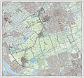 2013-MiddenDelfland.jpg 2,272 × 2,119; 3.53 MB
-
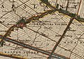
 Aalkeet polders 1712.JPG 664 × 485; 89 KB
-
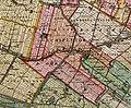
 Ackerdyksepolder1712.JPG 607 × 460; 79 KB
-
 BAG woonplaatsen - Gemeente Midden-Delfland.png 2,419 × 2,419; 896 KB
-
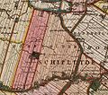
 Commandeurs polder 1712.JPG 599 × 421; 71 KB
-
 Dorp kruikius 1712.jpg 1,855 × 1,523; 1.04 MB
-
 Dorppolder1712.JPG 532 × 472; 69 KB
-
 Duifpolder1712.JPG 626 × 405; 77 KB
-
 Dykpolder 1712.JPG 526 × 420; 65 KB
-
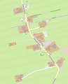
 Foppenpolder1712.JPG 638 × 472; 83 KB
-
 Gem-Midden-Delfland-2014Q1.jpg 4,590 × 4,285; 10.6 MB
-
 Gem-Midden-Delfland-OpenTopo.jpg 4,413 × 4,171; 2.8 MB
-
 Harnaschpolder 1712.JPG 521 × 444; 60 KB
-
 Hoekwater polderkaart - Dijkpolder (Maasland).jpg 2,290 × 1,510; 826 KB
-
 Hoekwater polderkaart - Dorppolder.PNG 494 × 397; 452 KB
-
 Hoekwater polderkaart - Duifpolder.PNG 342 × 445; 348 KB
-
 Hoekwater polderkaart - Groeneveldse polder.PNG 419 × 327; 335 KB
-
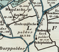 Hoekwater polderkaart - Hodenpijlsche polder.PNG 415 × 365; 365 KB
-
 Hoekwater polderkaart - Holierhoekse- en Zouteveense polder.PNG 424 × 531; 464 KB
-
 Hoekwater polderkaart - Kerkpolder (Den Hoorn).PNG 372 × 374; 332 KB
-
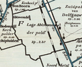 Hoekwater polderkaart - Lage Abtwoudsche polder.PNG 491 × 406; 450 KB
-
 Hoekwater polderkaart - Woudsche Droogmakerij.PNG 502 × 363; 458 KB
-
 Kaart 't Woudt1712.jpg 1,279 × 976; 308 KB
-
 Kaart Den Hoorn1712.jpg 1,279 × 976; 372 KB
-
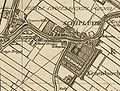 Kaart Schipluiden1712.jpg 1,280 × 974; 390 KB
-
-
 Kadastrale kaart 1818 verzamelplan gemeente Sint Maartensregt.jpg 11,722 × 7,730; 10.41 MB
-
 Kadastrale kaart verzamelplan gemeente Groeneveld.jpg 12,052 × 7,836; 12.65 MB
-
 Lookwatering.jpg 614 × 636; 70 KB
-
 Map - NL - Midden-Delfland (2009).svg 625 × 575; 3.1 MB
-
 MD de kapel.png 701 × 477; 75 KB
-
 MD den hoorn.png 701 × 609; 319 KB
-
 MD maasland.png 767 × 641; 216 KB
-
 MD negenhuizen.png 481 × 593; 51 KB
-
 MD t woudt.png 705 × 711; 69 KB
-
 MD zouteveen.png 881 × 655; 56 KB
-
 Midden Delfland Floris Balthasar 1611.jpg 3,404 × 4,489; 4.53 MB
-
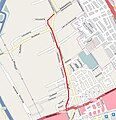
 N223.PNG 560 × 447; 207 KB
-
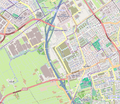
 N468.PNG 618 × 531; 287 KB
-
 Oude Campspolder 1712.JPG 601 × 473; 76 KB
-
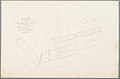
 Tanthofkadekaart.jpg 300 × 416; 68 KB


.jpg)


.PNG)


.svg)


