Category:Maps of Lansingerland
Appearance
Wikimedia category | |||||
| Upload media | |||||
| Instance of | |||||
|---|---|---|---|---|---|
| Category combines topics | |||||
| Lansingerland | |||||
municipality in the Netherlands | |||||
| Instance of |
| ||||
| Location | South Holland, Netherlands | ||||
| Inception |
| ||||
| Population |
| ||||
| Area |
| ||||
| Elevation above sea level |
| ||||
| official website | |||||
 | |||||
Subcategories
This category has the following 4 subcategories, out of 4 total.
*
- Maps of Bergschenhoek (6 F)
- Maps of Bleiswijk (14 F)
Media in category "Maps of Lansingerland"
The following 15 files are in this category, out of 15 total.
-
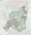
2013-Lansingerland.jpg 1,923 × 2,164; 2.89 MB
-
BAG woonplaatsen - Gemeente Lansingerland.png 2,419 × 2,419; 796 KB
-
Gem-Lansingerland-2014Q1.jpg 3,961 × 4,316; 8.85 MB
-
Gem-Lansingerland-OpenTopo.jpg 3,649 × 4,127; 2.44 MB
-
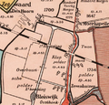
Hoekwater polderkaart - Klappolder.PNG 486 × 466; 502 KB
-
Hoekwater polderkaart - Noordpolder (Berkel).PNG 469 × 486; 518 KB
-
Hoekwater polderkaart - Oostmeerpolder (Berkel).PNG 597 × 516; 703 KB
-
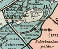
Hoekwater polderkaart - Oude Leedsche polder.PNG 603 × 426; 625 KB
-
Hoekwater polderkaart - Polders rond Berkel.PNG 629 × 572; 800 KB
-
Hoekwater polderkaart - Westpolder (Berkel).PNG 482 × 432; 503 KB
-
Hoekwater polderkaart - Zuidpolder (Berkel).PNG 499 × 423; 503 KB
-
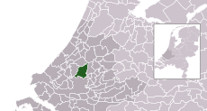
LocatieLansingerland.png 280 × 130; 12 KB
-
Map - NL - Lansingerland (2009).svg 625 × 575; 3.62 MB
-
Map - NL - Municipality code 1621 (2009).svg 300 × 160; 530 KB
-
NL - locator map municipality code GM1621 (2016).png 2,125 × 1,417; 478 KB


