Category:Maps of Teylingen
Jump to navigation
Jump to search
Wikimedia category | |||||
| Upload media | |||||
| Instance of | |||||
|---|---|---|---|---|---|
| Category combines topics | |||||
| Teylingen | |||||
municipality in the Netherlands .JPG)   .png) | |||||
| Pronunciation audio | |||||
| Instance of |
| ||||
| Location | South Holland, Netherlands | ||||
| Inception |
| ||||
| Population |
| ||||
| Area |
| ||||
| Elevation above sea level |
| ||||
| Replaces | |||||
| official website | |||||
 | |||||
Subcategories
This category has the following 4 subcategories, out of 4 total.
M
- Maps of Sassenheim (3 F)
- Maps of Voorhout (4 F)
- Maps of Warmond (12 F)
Media in category "Maps of Teylingen"
The following 15 files are in this category, out of 15 total.
-
 2013-Teylingen.jpg 1,561 × 1,701; 1.9 MB
-
 BAG woonplaatsen - Gemeente Teylingen.png 2,419 × 2,419; 674 KB
-
 Gem-Teylingen-2014Q1.jpg 2,967 × 3,416; 5.3 MB
-
 Gem-Teylingen-OpenTopo.jpg 2,923 × 3,314; 1.47 MB
-
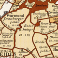 Hoekwater polderkaart - Boterhuispolder.PNG 421 × 420; 489 KB
-
 Hoekwater polderkaart - Hofpolder (Warmond).PNG 419 × 321; 367 KB
-
 Hoekwater polderkaart - Veen- en Geestlanden.PNG 449 × 601; 722 KB
-
 Hoekwater polderkaart - Veerpolder (Warmond).PNG 431 × 320; 383 KB
-
 Hoekwater polderkaart - Voorhofpolder (Warmond).PNG 384 × 320; 334 KB
-
 Hoekwater polderkaart - Zwanburgerpolder.PNG 386 × 368; 394 KB
-
 Kagerplassen 1665.JPG 746 × 539; 130 KB
-
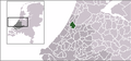 Locatie Teylingen.png 280 × 130; 8 KB
-
 Map - NL - Teylingen (2009).svg 625 × 575; 2.15 MB
-
 Netherlands, Kagerplassen, map of 1617.jpg 6,494 × 4,083; 10.1 MB
-
 Netherlands, Warmond, Lakerpolder, Tuinder- of Kogjespolder.jpg 5,488 × 3,504; 3.01 MB


.PNG)

.PNG)
.PNG)


.svg)

