Category:Maps of Goeree-Overflakkee
Jump to navigation
Jump to search
Nederlands: Afbeeldingen van kaarten in de gemeente Goeree-Overflakkee in de provincie Zuid-Holland in het westen van Nederland
Wikimedia category | |||||
| Upload media | |||||
| Instance of | |||||
|---|---|---|---|---|---|
| Category combines topics | |||||
| Goeree-Overflakkee | |||||
island and municipality in the Netherlands    .png)  | |||||
| Instance of | |||||
| Location | South Holland, Netherlands | ||||
| Has part(s) | |||||
| Inception |
| ||||
| Population |
| ||||
| Area |
| ||||
| Elevation above sea level |
| ||||
| Replaces |
| ||||
| official website | |||||
 | |||||
Subcategories
This category has the following 6 subcategories, out of 6 total.
C
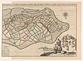
- Caartboeck van Voorne, 1701 (23 F)
Media in category "Maps of Goeree-Overflakkee"
The following 38 files are in this category, out of 38 total.
-
 1660 66 Marsdiep Mase Goos.jpg 5,500 × 4,525; 2.33 MB
-
 2013-GoereeOverflakkee.jpg 7,025 × 4,138; 10.86 MB
-
 2013-Top33-GoereeOverflakkee.jpg 4,989 × 2,962; 7.1 MB
-
 Admiralty Chart No 122 Mouths of River Maas, Published 1928.jpg 16,265 × 11,124; 40.44 MB
-

-
 Atlante Neroni - Goeree.jpg 2,306 × 1,495; 799 KB
-

-
 Detail van topografische kaart - Goeree - 20411450 - RCE.jpg 1,200 × 852; 214 KB
-
 Gem-Goeree-Overflakkee-2014Q1.jpg 13,879 × 8,044; 29.04 MB
-
 Gem-Goeree-Overflakkee-OpenTopo.jpg 14,973 × 8,312; 9.31 MB
-
 Goeree-Blaeu-1645.jpg 542 × 444; 75 KB
-
 Hondekop (Westvoorn).tif 6,657 × 4,670; 1.25 MB
-
 Hondekop Westvoorn.jpg 6,657 × 4,670; 11.26 MB
-

-

-

-

-

-
-

-
 Kaart Zuidhollandse eilanden 1748.png 1,729 × 1,534; 5.19 MB
-
 Kaart Zuidhollandse eilanden in 1421 - A. Beekman.jpg 4,925 × 3,310; 3.5 MB
-
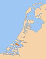
 LocatieGoereeOverflakkee.png 280 × 130; 10 KB
-
 Map - NL - Municipality code 1924 (2019).svg 300 × 160; 443 KB
-
 Map - Special Collections University of Amsterdam - OTM- HB-KZL 34.02.18.tif 6,608 × 5,096; 96.34 MB
-
 Map - Special Collections University of Amsterdam - OTM- HB-KZL I 2 A 2 (05).jpg 11,387 × 7,353; 27.62 MB
-
 Map - Special Collections University of Amsterdam - OTM- HB-KZL I 2 A 2 (12).jpg 9,754 × 6,984; 30.67 MB
-
 Map - Special Collections University of Amsterdam - OTM- HB-KZL I 2 A 2 (17).jpg 9,741 × 6,950; 31.78 MB
-
 Map - Special Collections University of Amsterdam - OTM- HB-KZL I 2 A 3 (05).jpg 13,398 × 6,551; 23.89 MB
-
 Map NL - Goedereede - Ouddorp.svg 800 × 600; 21 KB
-
 Map NL - Oostflakkee - Achthuizen.png 800 × 600; 10 KB
-
 Map NL - Oostflakkee - Den Bommel.png 800 × 600; 10 KB
-
 Map NL - Oostflakkee - Oude-Tonge.png 800 × 600; 10 KB
-
 Map NL - Oostflakkee - Zuidzijde.png 800 × 600; 10 KB
-
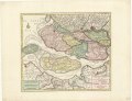
 Militaire kaart Goereese Zeegat Jan Blanken 1803.jpeg 1,187 × 844; 157 KB
-
 Mondingmaas1825.gif 800 × 512; 28 KB
-
 Overflakkee.jpg 247 × 316; 16 KB
-
 Zelandiae comitatus novissima tabula - per Nic. Visscher - btv1b53039211v (2 of 6).jpg 9,105 × 5,956; 9.14 MB


,_BI-B-FM-090-174.jpg)
_(titel_op_object),_RP-P-AO-14-60.jpg)
_(titel_op_object),_RP-P-1939-949.jpg)
_(titel_op_object),_RP-P-AO-14-66.jpg)
_Generale_caarte_ende_afbeeldinge_vanden_eylande_van_West_Voorn_(titel_op_object)_Voorne_Caart-boeck_Caartboeck_van_Voorne,_RP-P-AO-14-55C.jpg)
_Generale_caarte_vanden_lande_van_Voorne_inden_lande_van_Over_Flacquee_(titel_op_object)_Voorne_Caart-boeck_Caartboeck_van_Voorne,_RP-P-AO-14-55A-1.jpg)
_Generale_caarte_vanden_lande_van_Voorne_inden_lande_van_Over_Flacquee_(titel_op_object)_Voorne_Caart-boeck_Caartboeck_van_Voorne,_RP-P-AO-14-55A-2.jpg)


.svg)
.jpg)
.jpg)
.jpg)
.jpg)


.jpg)