Category:Maps of The Hague
Jump to navigation
Jump to search
Wikimedia category | |||||
| Upload media | |||||
| Instance of | |||||
|---|---|---|---|---|---|
| Category combines topics | |||||
| The Hague | |||||
city and municipality in the Netherlands, seat of the Dutch government      .svg) | |||||
| Spoken text audio | |||||
| Pronunciation audio | |||||
| Instance of |
| ||||
| Location |
| ||||
| Located in or next to body of water |
| ||||
| Visitor center | |||||
| Executive body | |||||
| Head of government | |||||
| Has part(s) | |||||
| Inception |
| ||||
| Population |
| ||||
| Area |
| ||||
| Elevation above sea level |
| ||||
| official website | |||||
 | |||||
Subcategories
This category has the following 12 subcategories, out of 12 total.
L
M
- Maps of Loosduinen (7 F)
- Maps of the Binnenhof (29 F)
- Maps of the Huis ten Bosch (10 F)
O
- OpenStreetMap maps of The Hague (27 F)
P
S
Media in category "Maps of The Hague"
The following 31 files are in this category, out of 31 total.
-
 LocatieDenHaag.png 280 × 130; 5 KB
-
 2013-DenHaag.jpg 2,845 × 2,357; 4.61 MB
-
 2015 Den Haag (The Hague - La Haye).jpg 7,086 × 5,886; 18.5 MB
-
 Agglomeratie 's-Gravenhage.png 1,428 × 1,238; 90 KB
-

-
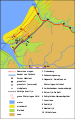 Archeologische kaart Romeins Rijnland-Delfland in Zuid-Holland.svg 807 × 1,280; 115 KB
-
 BAG woonplaatsen - Gemeente 's-Gravenhage.png 2,419 × 2,419; 1.22 MB
-
 Bombing of Bezuidenhout (1945-03-03).svg 562 × 423; 60 KB
-
 Den Haag-topografie.jpg 3,203 × 2,775; 7.46 MB
-
 DenHaag-plaats-OpenTopo.jpg 4,580 × 3,914; 12.5 MB
-
 DenHaag-stad-2014Q1.jpg 4,580 × 3,914; 12.13 MB
-
 Gem-sGravenhage-2014Q1.jpg 5,692 × 4,738; 18.75 MB
-
 Gem-sGravenhage-OpenTopo.jpg 5,752 × 4,812; 4.47 MB
-
 Gr. 0883.jpg 6,992 × 5,352; 8.61 MB
-
 Grachtenstelsel Den Haag (historisch).svg 2,655 × 2,352; 29 KB
-
 Grachtenstelsel Den Haag 2010.png 2,000 × 1,399; 515 KB
-
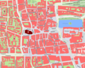
 Grote Markt, Den Haag.svg 656 × 661; 57 KB
-
 Grote of Sint-Jacobskerk op plattegrond oude binnenstad Den Haag.png 2,250 × 1,799; 1.9 MB
-
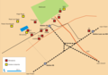 Haagse ministeries.png 1,637 × 1,141; 82 KB
-
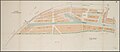 Het ontwerptekening oftewel kaart voor Laakhaven te 's-Gravenhage.jpg 10,039 × 4,372; 3.11 MB
-

-

-
 Metropoolregio Rotterdam Den Haag (Rotterdam The Hague Metropolitan Area).svg 1,063 × 567; 891 KB
-
 Mogelijke locaties moordaanslag op Aleid van Poelgeest en Willem Cuser in 1392.svg 3,122 × 2,286; 86 KB
-
 Natura2000 - Meijendel & Berkheide.png 2,016 × 2,267; 498 KB
-
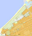 Natura2000 - Westduinpark & Wapendal.png 2,016 × 2,267; 257 KB
-
 Netherlands, area around The Hague in the 2nd Century AD.jpg 1,388 × 1,252; 626 KB
-
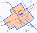
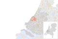 NL - locator map municipality code GM0518 (2016).png 2,125 × 1,417; 393 KB
-
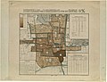
 Plattegrond van 's-Gravenhage uit ca. 1889.jpg 5,216 × 5,040; 6.98 MB
-
 Regio-15-Haaglanden-2009.png 444 × 454; 119 KB
-
 Vaillantlaan.png 827 × 800; 77 KB


.jpg)

_during_the_Roman_Empire,_with_legend_(NL_language).svg)


.svg)


.svg)


.svg)


.png)


