Category:Locator maps of Jammu and Kashmir (state)
Jump to navigation
Jump to search
States of India: Andhra Pradesh · Arunachal Pradesh · Assam · Bihar · Chhattisgarh · Goa · Gujarat · Haryana · Himachal Pradesh · Jharkhand · Karnataka · Kerala · Madhya Pradesh · Maharashtra · Manipur · Meghalaya · Mizoram · Nagaland · Odisha · Punjab · Rajasthan · Sikkim · Tamil Nadu · Telangana · Tripura · Uttar Pradesh · Uttarakhand · West Bengal
Union territories: Andaman and Nicobar Islands · Chandigarh · Dadra and Nagar Haveli and Daman and Diu · Delhi · Jammu and Kashmir · Ladakh · Lakshadweep · Puducherry
Former states of India: Jammu and Kashmir ·
Former union territories: Dadra and Nagar Haveli district · Daman and Diu ·
Union territories: Andaman and Nicobar Islands · Chandigarh · Dadra and Nagar Haveli and Daman and Diu · Delhi · Jammu and Kashmir · Ladakh · Lakshadweep · Puducherry
Former states of India: Jammu and Kashmir ·
Former union territories: Dadra and Nagar Haveli district · Daman and Diu ·
Media in category "Locator maps of Jammu and Kashmir (state)"
The following 12 files are in this category, out of 12 total.
-
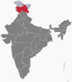 IN-JK (1954-2019).svg 512 × 583; 148 KB
-
 In-jk kaart.jpg 460 × 482; 29 KB
-
 India J&K state locator map.svg 1,574 × 1,738; 966 KB
-
 India Jammu and Kashmir.svg 1,500 × 1,615; 1.47 MB
-
 India-JAMMUANDKASHMIR.svg 1,486 × 1,734; 426 KB
-
 IndiaJammuKashmirCS.png 185 × 225; 33 KB
-
 Jammu and Kashmir in India (1951).svg 980 × 1,182; 200 KB
-
 Jammu and Kashmir in India (de-facto) (claims hatched).svg 1,500 × 1,615; 2.4 MB
-
 Jammu and Kashmir in India in 2019 (de-facto +claimed hatched) (disputed hatched).svg 1,500 × 1,615; 1.59 MB
-
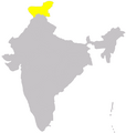
 Jammu and Kashmir in India.png 350 × 426; 76 KB
-
 Jammu Kashimr.png 748 × 790; 37 KB
-
 Kashmir-india.png 197 × 203; 9 KB
.svg)


.svg)
_(claims_hatched).svg)
_(disputed_hatched).svg)

