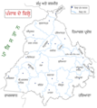
Category:Maps of Punjab, India
Appearance
States of India: Andhra Pradesh · Arunachal Pradesh · Assam · Bihar · Chhattisgarh · Goa · Gujarat · Haryana · Himachal Pradesh · Jharkhand · Karnataka · Kerala · Madhya Pradesh · Maharashtra · Manipur · Meghalaya · Mizoram · Nagaland · Odisha · Punjab · Rajasthan · Sikkim · Tamil Nadu · Telangana · Tripura · Uttar Pradesh · Uttarakhand · West Bengal
Union territories: Andaman and Nicobar Islands · Chandigarh · Dadra and Nagar Haveli and Daman and Diu · Delhi · Jammu and Kashmir · Ladakh · Lakshadweep · Puducherry
Former states of India: Jammu and Kashmir ·
Former union territories: Dadra and Nagar Haveli district · Daman and Diu ·
Union territories: Andaman and Nicobar Islands · Chandigarh · Dadra and Nagar Haveli and Daman and Diu · Delhi · Jammu and Kashmir · Ladakh · Lakshadweep · Puducherry
Former states of India: Jammu and Kashmir ·
Former union territories: Dadra and Nagar Haveli district · Daman and Diu ·
Wikimedia category | |||||
| Upload media | |||||
| Instance of | |||||
|---|---|---|---|---|---|
| Category combines topics | |||||
| Punjab | |||||
Indian state | |||||
| Instance of | |||||
| Part of | |||||
| Named after | |||||
| Location | India | ||||
| Capital | |||||
| Legislative body | |||||
| Executive body | |||||
| Official language | |||||
| Head of state |
| ||||
| Head of government |
| ||||
| Inception |
| ||||
| Population |
| ||||
| Area |
| ||||
| Replaces |
| ||||
| Different from | |||||
| official website | |||||
 | |||||
Subcategories
This category has the following 9 subcategories, out of 9 total.
Pages in category "Maps of Punjab, India"
This category contains only the following page.
Media in category "Maps of Punjab, India"
The following 32 files are in this category, out of 32 total.
-
11 prachin kaler abasthan-1.jpg 1,654 × 2,209; 348 KB
-
Administrative division of Punjab.png 720 × 774; 192 KB
-
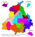
Assembly Constituencies map district wise.png 800 × 852; 311 KB
-
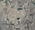
Bhagwangarh, Bathinda, Panjab.png 2,689 × 2,246; 522 KB
-
Bhangalan.png 650 × 550; 445 KB
-
British Punjab before partition.tif 1,411 × 892; 567 KB
-
Dhudikemap.gif 600 × 371; 31 KB
-
Divisions of Punjab.png 540 × 600; 134 KB
-
Guru Gobind Singh Marg.JPG 3,264 × 2,448; 2.17 MB
-
Hazara division.jpg 524 × 737; 94 KB
-
Husnar, Sri Muktsar Sahib, Panjab.png 2,688 × 2,248; 546 KB
-
Kunjah Map 2007.gif 2,495 × 2,153; 55 KB
-
Lakhpur New Map.png 556 × 599; 146 KB
-
Majority Punjabi Speaking Areas.png 760 × 885; 20 KB
-
Map of Assembly Constituencies of Punjab, India in 2022.jpg 2,948 × 4,102; 1.71 MB
-
Map of Punjab (India) with the flag of the Khalistan movement.png 800 × 925; 73 KB
-
Map of the Northern Part of the Punjab and of Kashmir in 1846, by John Walker.jpg 6,418 × 9,181; 12.77 MB
-
Map showing Sikh Empire's territory at the time of Ranjit Singh’s passing away.jpg 4,784 × 4,020; 1.76 MB
-
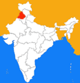
Panjab.png 197 × 203; 9 KB
-
Punjab % Sikhs 2011.png 7,102 × 8,223; 2.92 MB
-
Punjab district map.png 2,467 × 2,741; 635 KB
-
Punjab in 1912.jpg 1,409 × 1,895; 658 KB
-
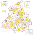
Punjab PC-AC map.png 720 × 766; 308 KB
-
Punjab region.png 1,280 × 1,023; 391 KB
-
Punjab, India districts 22 pa.png 2,467 × 2,761; 842 KB
-
Raipur, Mansa, Panjab.png 2,685 × 2,243; 755 KB
-
Recovery map of Punjab India.png 1,084 × 1,200; 128 KB
-
Rupnagar District Tourist Places.png 888 × 842; 44 KB
-
Sangrur lok sabha map.svg 580 × 618; 1.4 MB
-
Talhan Location Map.png 556 × 599; 146 KB
-
Talhan Location.png 556 × 599; 146 KB


